
Wickenburg Mtns./Copperopolis
Traverse through the Wickenburg Mountains as you follow first graded roads then old mining roads through sandy washes and down difficult, rocky hills. Pass the grave of Isaac Bradshaw on your way to the mining town of Copperopolis at the end of the trail.
Trail update: There are multiple reports that this trail is blocked/in-accessible at Iron Springs due to trees. A bypass up Constellation Road allows you avoid this area and still access Copperopolis & Castle Creek. We have not confirmed the condition of the bypass or updated our Google Earth Tracks yet.
Where to go:
From the Loop 101 and U.S. 60 in Peoria, head northwest towards Wickenburg for 38 miles. Turn right just before the McDonalds onto El Recero Drive. This road becomes Constellation road which you will follow for another 8.3 miles. Staging for the trail is off to the left here where Buckhorn Road goes right. Of course, you can stage at any point before this (there are many along Constellation Road) and ride up to this point.
Trail Description:
Head east on the graded Buckhorn Road. Stay left at 0.9 miles. The trail begins weaving in and out of dry washes as it climbs. Use caution on this section since there are numerous hairpin turns. At 4.2 miles, Buckhorn Road will turn sharp right, continue straight off the main road and past an old corral. The trail gets rough as it climbs up out of the basin but once you are at the top, you will have great views of Wickenburg behind you.
Pass through a gate at 4.9 miles as the trail heads downhill. Stay right at 6.3 miles as the trail passes through the remains of Constellation City. There are big tailing piles off to the right here you can check out. There is a gated road that goes left here which leads to private mining claims that were for sale when we were here. From here on out the trail gets rougher. You’ll drop down a long and narrow shelf road and pass through a gate at 6.6 miles. Use caution as you descend as recent rains can cause changes to this portion of the trail.
Once at the bottom of the hill at 7.2 miles, the trail crosses the same wash six different times. Again, depending on recent rain, this can be a trick portion with ledges forming between the trail and the wash. At 7.6 miles you’ll turn left downhill through the toughest washout. Longer wheel-base vehicles may have trouble here but once you are through here, you have conquered most of the difficult sections of the trail. The trail climbs and then descends through Iron Springs at 7.8 miles. This will be marked by the very green trees and maybe even a water crossing at this point. Just after the springs, be sure to make an important right hand turn at the 8.0 mile mark. The trail continues to snake its way eastward and gets rockier. At the 10.0 mile mark, you can turn left off the trail and make a quick side trip to the Crown Point Mine, visible as you descend just before this point. The mine has a few foundations left and a good spot for a break. Continuing on, stay right at 10.6 miles as the trail continues to cross several dry washes. Stay to the right as at 11.2 miles as you pass a corral and then turn left into a creek at 11.4 miles. Bradshaw’s grave is off to the left at 11.7 miles. It’s hard to miss since there is a white fence around it, a marker, and a very large cactus marking the site.
Continuing past the grave, the trail passes through more mining areas and crosses several more washes. At 13.0 miles you will begin another steep descent. The trail switchbacks near the bottom and crosses a wash before continuing uphill. This is the second hardest portion of the trail as it can get rocky and require careful wheel placement. At 14.3 miles you’ll pass through the noticeable remains of the UFO mine. While we didn’t find any structures left, it was still a neat area to check out and give the quads a break. After the UFO mine, the trail makes a sharp right as it heads south. The trail splits at 14.7 miles. Stay to the left to get to Copperopolis – to the right is the optional return trip to the staging area used later. This spur trail to Copperopolis is another rough section. It gets rocky and rutted as you approach the mine. Ignore side roads staying straight through a gate at 15.7 miles. You’ll reach the Copperopolis Town site at 15.8 miles. There is a lot to check out here including foundations of a few buildings, numerous tailing piles and several adits in the area. Explore with caution.
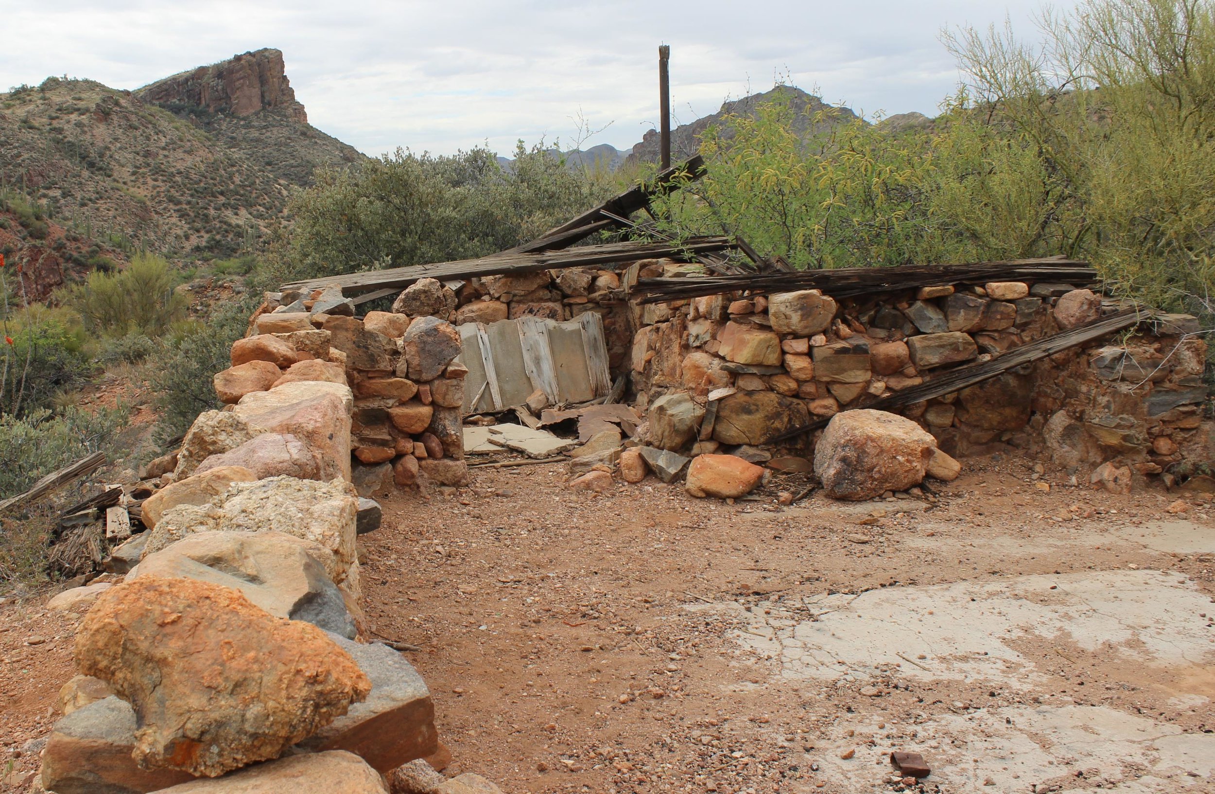
Ruins at Copperopolis.

Bradshaw’s Grave along the trail.
Upon leaving Copperopolis, you have a few choices. If you want, you can backtrack another 15.8 miles back to the staging area. Or, you can elect to take an easier and different route back to Buckhorn Road, which connects to the staging area or Castle Hot Springs Road. To do this, head south 1.1 miles from Copperopolis back to the trail split where you turned left. Turn left here (right would be the route you came in on). The alternate way back descends from this trail junction and at 0.7 miles enters a wide wash. The trail winds its way through the wash, you’ll likely have to follow other’s tire tracks to find the way. Depending on recent storms, this can be a very easy trip, or there could be debris on the trail. Do not attempt this if there is rain in the forecast. At 2.0 miles, the canyon narrows and almost becomes a box canyon. This is a really fun place to drive through in dry conditions but would be the worst place to be in a flash flood. The trail continues to follow this wash until you pass through a gate at 5.2 miles. After passing through the gate, you will be back on Buckhorn Road. Continuing left on Buckhorn Road would eventually take you to Castle Hot Springs. To return to Wickenburg, turn right onto Buckhorn Road. You’ll follow this graded road all the way back to the beginning of the trail. At 15.4 miles, you will rejoin your original path and at 19.6 miles from Copperopolis you will reach Constellation Road.
Notes & Trail Ratings:
This trail certainly isn’t for the novice. The trail contains several difficult sections that require high clearance and 4-wheel drive. The trail is rated a ‘7’ because of these challenges. Majority of the trail is easy going graded roads however don’t underestimate it. Trail erosion and rainy weather can make this even more difficult. Allow 4-6+ hours to complete the full 35 mile loop and plan on a full day if you want to stop a lot. This trail doesn’t get a lot of traffic so travel prepared.