

Yavapai County
Copper Chief Mine
Producing over 1.3 million pounds of copper, this mine sits just below Mingus Mountain.
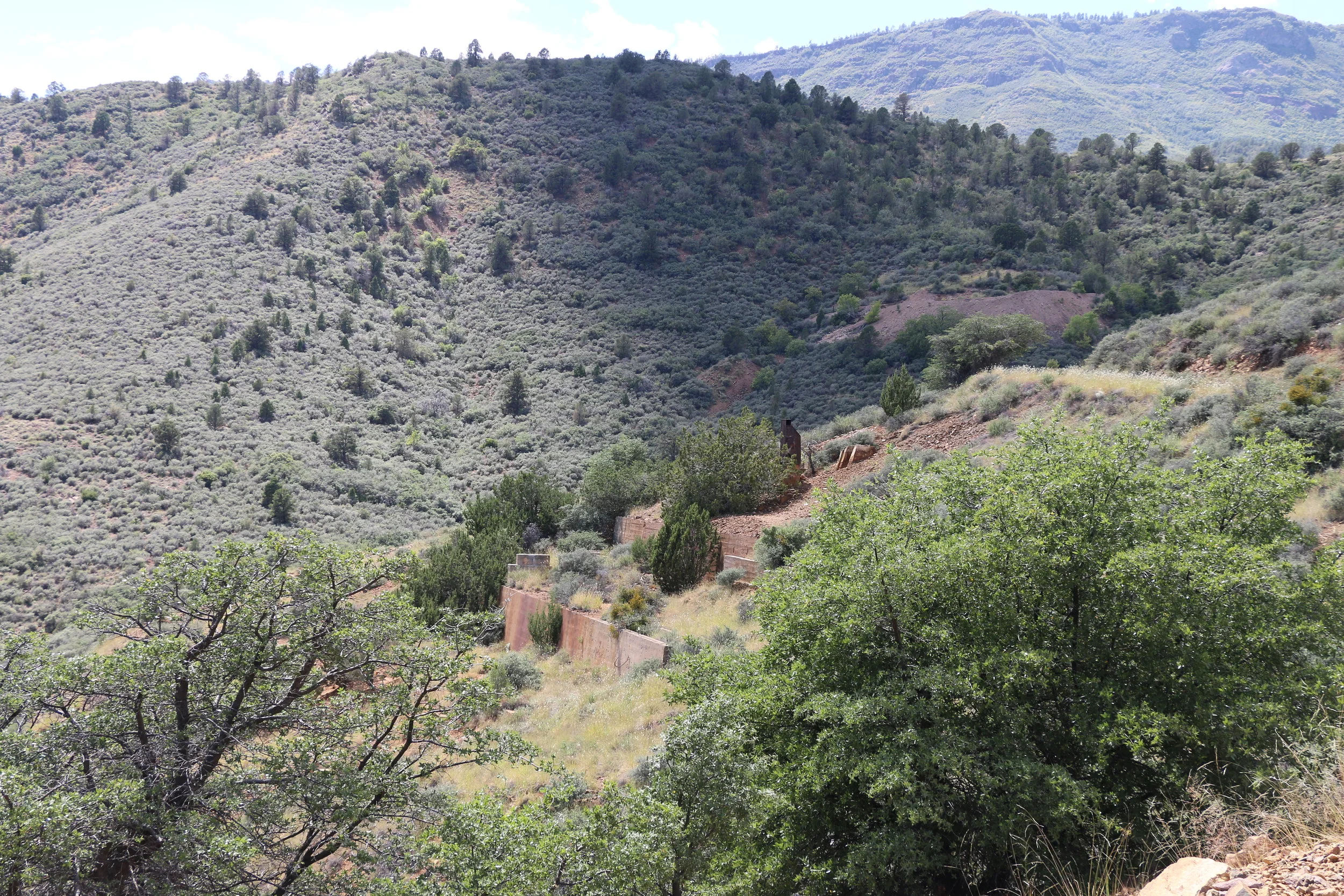
Cement foundations at the Copper Chief.
The Copper Chief Mine is a former copper producer located just a few miles southeast of the massive boomtown of Jerome. In addition to copper, the Copper Chief also produced gold, silver and other minerals over its nearly 50 year lifetime. Just below the top of Mingus Mountain, the mine has a great view of the Verde Valley below.
Production in the area began in 1901. The surrounding geology made this area prime for copper deposits. The local faults and massive sulfide “lenses” is where most of the copper ore was found. The Copper Chief complex was actually split into two separate mines. The eastern half of the workings were known as the Iron King or Equator Mine, while the western half was referred to as the Copper Chief Mine.
The mine became most profitable between 1904 and 1905. Around 30,000 tons of sulfide ore was produced during this time, which yielded 1,300,000 pounds of copper. The success of the Copper Chief, while substantial, was often overshadowed by its much more successful neighbor, Jerome. Ore from the mine was likely processed initially on site as there is evidence of stamp mill foundations. Following the construction of a smelter in Clarkdale in 1912, it is possible that ore from the Copper Chief was also shipped down the mountain for processing.
The mine continued to produce through WWII before being sold to Phelps-Dodge, who also owned many of the other mines in Jerome and throughout the Black Hills at the time. However, production in the later years never matched the success early on. In 1948, the property was shut down. In addition to copper -- gold, silver, lead, and zinc were also found in lesser quantities over its lifetime. In all, the Copper Chief featured a 350’ shaft and over 2,000’ of drift tunnels.
Today, numerous cement foundations, an ore bin, and lots of metal shards and rods remain strewn about and visible from the main road. The property is owned by Freeport-McMoRan (formerly Phelps-Dodge) who actively manage wastewater runoff. The Copper Chief was part of the Volunteer Remediation Program in which numerous shafts were sealed off and water runoff managed in tanks at the lower level of the mine complex. The Copper Chief sits about 4 miles southwest of Clarkdale. It is accessed via F.R. 493 and continues uphill as part of Mingus Mountain Trail. Observe all posted signs and gates at the mine. Most of the ruins are visible from F.R. 493.


Sources:
“Copper Chief Mine (Copper Chief Orebody; Iron King Mine; Equator Mine; Iron King-Equator Mine; Copper Chief-Iron King-Equator Mine; Hayden Development Co. Property).” Mindat.org, www.mindat.org/loc-46783.html.
“Copper Chief Mine.” Mineral Resource Data System (MRDS), United States Geological Survey , mrdata.usgs.gov/mrds/show-mrds.php?dep_id=10048232.
“Copper Chief Mine.” Western Mining History, westernmininghistory.com/mine_detail/10048232/.
“Iron King/Copper Chief Mine | VRP Site.” ADEQ Arizona Department of Environmental Quality, azdeq.gov/iron-kingcopper-chief-mine-vrp-site.