Yavapai County
Blue Bell Mine
This copper mine operated from 1895 to 1948 and produced over $14 million.
The Blue Bell Mine is a former copper mine and stone quarry south of Mayer in the eastern Bradshaw Mountains. The Blue Bell sits just a few miles northeast of the DeSoto Mine in the Big Bug Mining District. The mine yielded high quantities of moderately high-value copper ore among other lesser productive minerals like gold, silver, lead, and zinc. The mine is accessed by the short but difficult FR 93 from Cleator. 4-wheel drive and high clearance is required to get to the mine site.
The history of the Blue Bell dates back to the 1870s. Much like the nearby DeSoto Mine, this area was first prospected during that time. Prospectors likely saw the large collections (or “lenses”) of different colored rocks on the surface, indicating copper ore was present. It wasn’t until about 1895 when the mine began producing. Initial ore was shipped out one year later and assayed at 15% copper – quite high for the area. Primary workings at the time remained shallow and the main shafts were only sunk to about 200 feet.
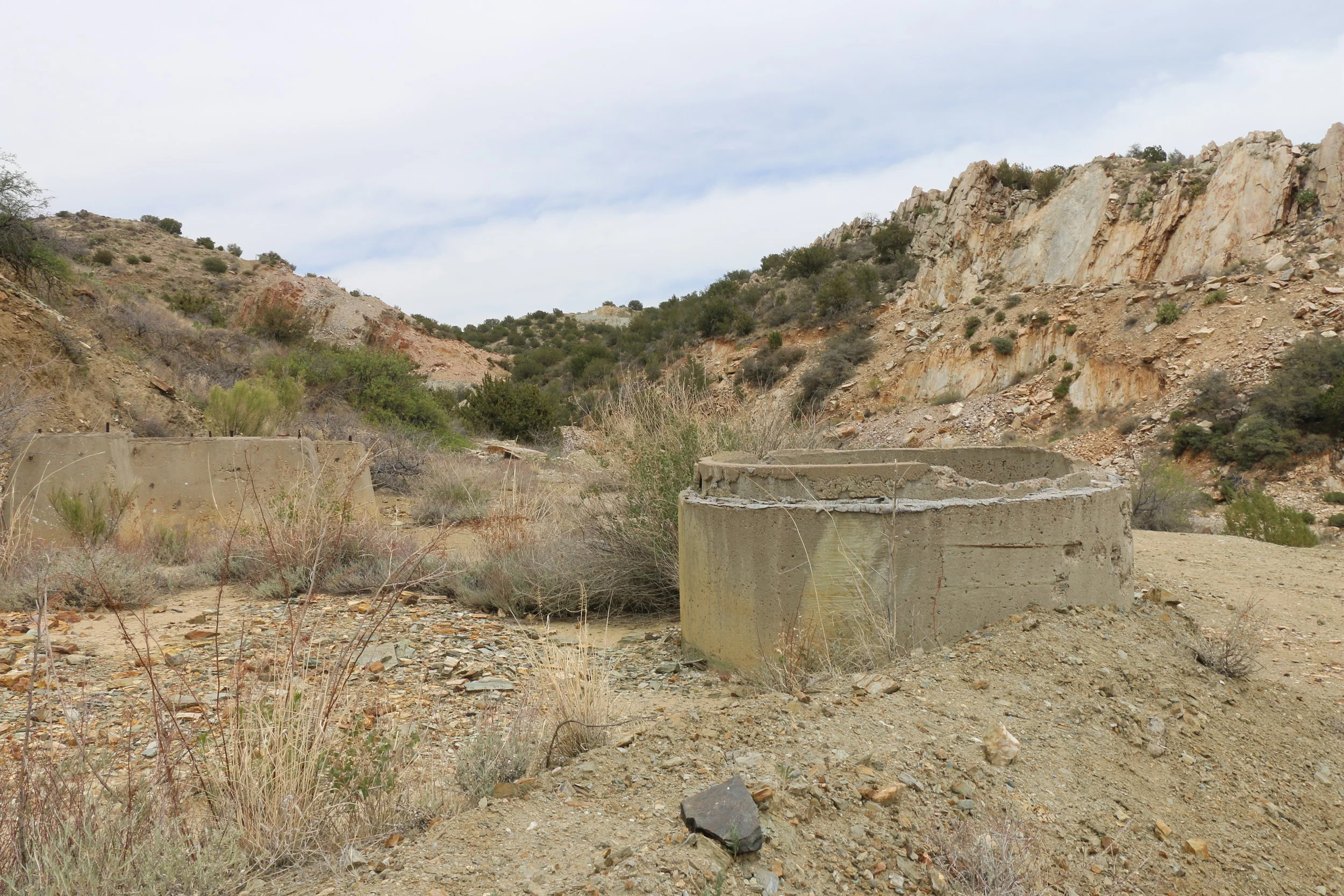
Cement foundations at Blue Bell. Evidence of the stone quarry (worked later) is also visible.
By 1902, additional veins had been discovered and additional shafts were sunk. The Consolidated Arizona Smelting Company acquired the operation in 1905. This company owned and operated the DeSoto Mine and its smelter in Humboldt. The arrival of the Bradshaw Mountain Railroad brought with a cheaper and more economical way to get ore to the smelter. The railroad passed nearby, but was still over three miles away, so the owners were forced to create a three mile long tramway to haul out the ore down the 4,500’mountain to the Blue Bell siding.
The mine continued to churn out high-quality ore for the next year. 1905-1908 and 1909-1913 were very productive years. Workings continued down to the 1000 foot level as miners continued to chase lenses of copper oxides. The onset of World War I saw an increase in demand for copper, and saw the most successful years of the mine. From 1917-1918 alone, the mine produced nearly 275,000 tons of ore, pulling out 200 tons a day. The aerial tramway could haul about 20 tons an hour. During the war, copper was so valuable that lower quality ore was acceptable for mining. During this time, ore of about 2.5% was considered “valuable and economically feasible”.
Following the war and the plummeting price of copper, the mine sat idle in 1921 and ’22. The company that owned the mine re-organized, becoming the Southwest Metals Company. Work continued in 1922, but the need for high-grade ore forced miners to work down to the 1500’ level by 1925. In the lower levels of the mine standing water became a problem. 150,000 gallons needed to be pumped out daily to keep the mine operational.
One complete building remains on the west side of the mine.
In 1927, following the closure of the Humboldt Smelter, all work and pumping at the mine was stopped. In 1931, the railroad tracks were pulled up and the tram was removed. Water flooded the lower 800 feet of the mine. Following World War II, the mine was leased out and worked with limited success. From 1944-1948, about 8,000 tons were pulled out and hauled via truck to Mayer. The mine was productive on and off for the next 40 years. Leaching was briefly attempted on site after further prospecting but was never found to be successful. The last operational years of the mine were completed by a stone company who quarried the area and produced large limestone blocks for commercial use.
The success of the Blue Bell can largely be attributed to timing. Much of the high-grade ore was found in the early years of the mine (which is typical), but the onset of WWI brought on a second wave of success. The most successful years were from 1896-1920 when the mine produced around 1,200,000 tons of ore valued at approximately $14 million. In all, copper was found at about 3%, silver at 1.5%, and just 0.04% gold per ton. Underground workings totaled about 30,000 feet.
Remains left today at the Blue Bell are moderate to minimal. As you approach the mine, you can see it has a fairly large footprint in the gulch. Evidence of later, more modern mining efforts can be seen. Numerous shafts and adits can be found scattered around the property. One nearly complete building remains and numerous foundations are strewn about the main parking area. Allow for some time to walk the property. On the east side of the mine site, we found a small door and cave carved into the bedrock to house the explosives. The road from Cleator is only about 5 miles and follows much of the old Bradshaw Mountain rail bed. Head due north out of downtown Cleator on FR 93/9273A. The trail is easy at first, getting progressively more difficult as you approach the mine. 4-wheel drive with good clearance and careful tire placement are required at times. Stock vehicles will have difficulty reaching the Blue Bell. I’m not sure on the condition of the road coming in from Mayer at this time but it is likely in similar shape.
Sources:
Ascarza , William. “Central Arizona's Blue Bell Mine Became Well-Known Copper Producer.” Arizona Daily Star, Tucson.com, 11 Dec. 2016, http://tucson.com/news/state-and-regional/central-arizona-s-blue-bell-mine-became-well-known-copper/article_bc5dea93-07b3-5e03-b283-62c91c954a01.html
“Blue Bell Mine (Blue Bell Mine and Quarry; Patented claims 1528…” Mindat.org. Web. https://www.mindat.org/loc-44356.html
http://docs.azgs.az.gov/OnlineAccessMineFiles/A-B/BluebellmineYavapai1210-2.pdf (pages 50-65)
http://docs.azgs.az.gov/SpecColl/1986-01/1986-01-0035-1.pdf (pages 2-15)


