

Northern AZ Expedition, II | 2011
We travel 1000 miles on this epic trip from Flagstaff — to 4-Corners — and back.
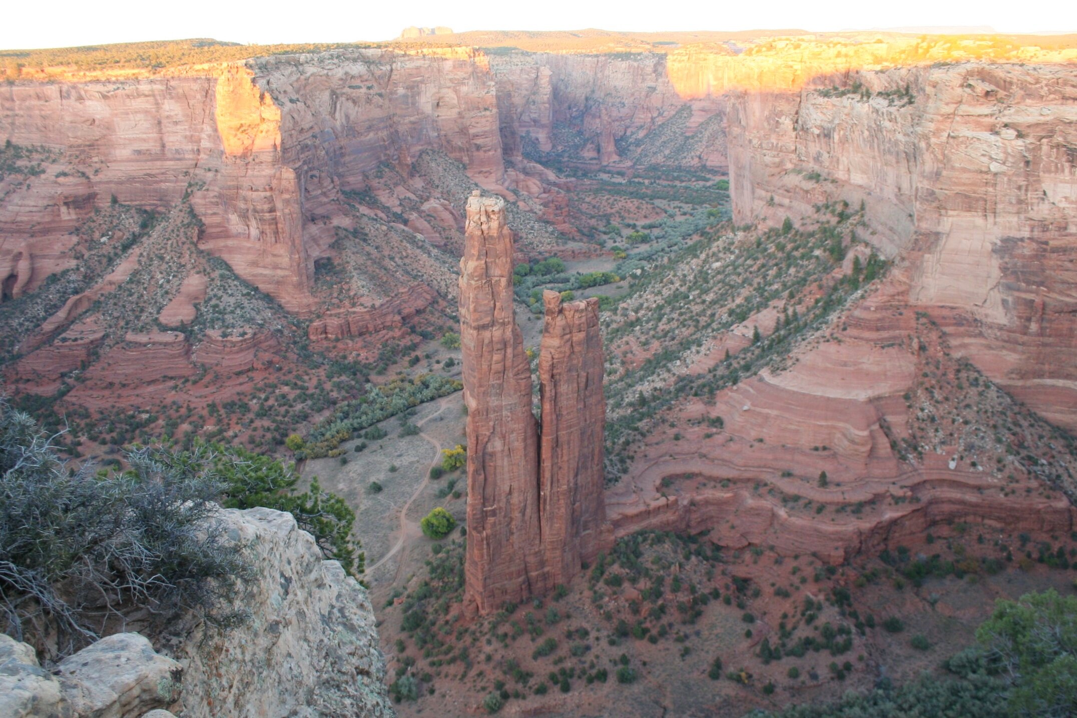
The iconic Spider Rock at Canyon de Chelly.
Our trip up once again to northern Arizona can be considered an expedition most definitely. In October 2010, we took our "Northern Arizona Expedition" up to Flagstaff where we stayed in Fernow Cabin and saw sights like Jerome, Montezuma Castle, Sunset Crater, Wupatki, and Meteor Crater to name a few. But – there was still a lot of unexplored land up in northern Arizona that we hadn't covered yet. In October of 2011, we planned to head back up and explore some more, including the furthest reaches of the state. So, with our cousin Bill from Massachusetts, another cousin Daniel from Ohio, and Matt, Stephen, and Scotty from the azoffroad.net crew, we set out for the weekend to conquer northern Arizona.
Day 1 — 2:00 PM:
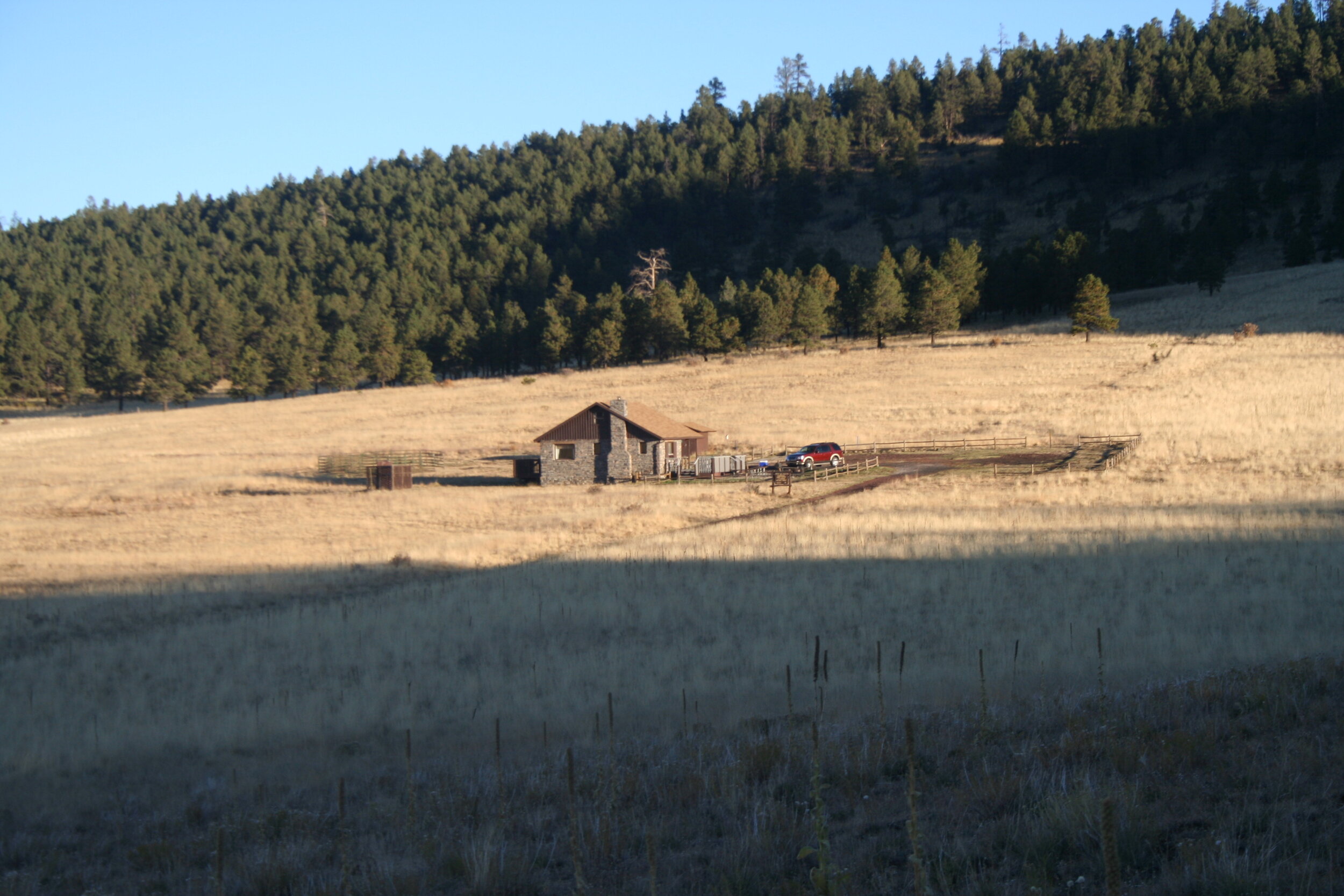
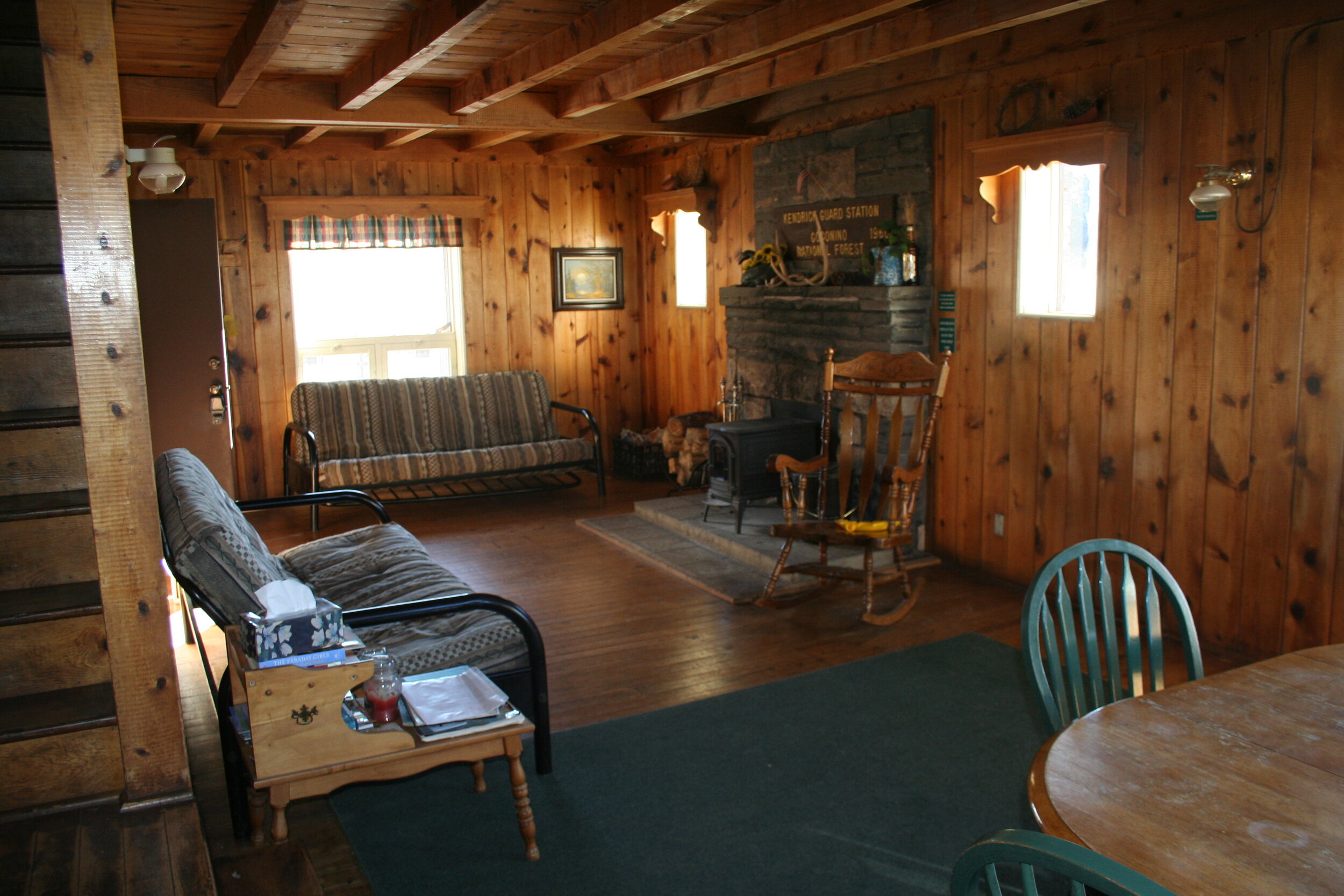
Kendrick Cabin north of Flagstaff was our base for the trip.
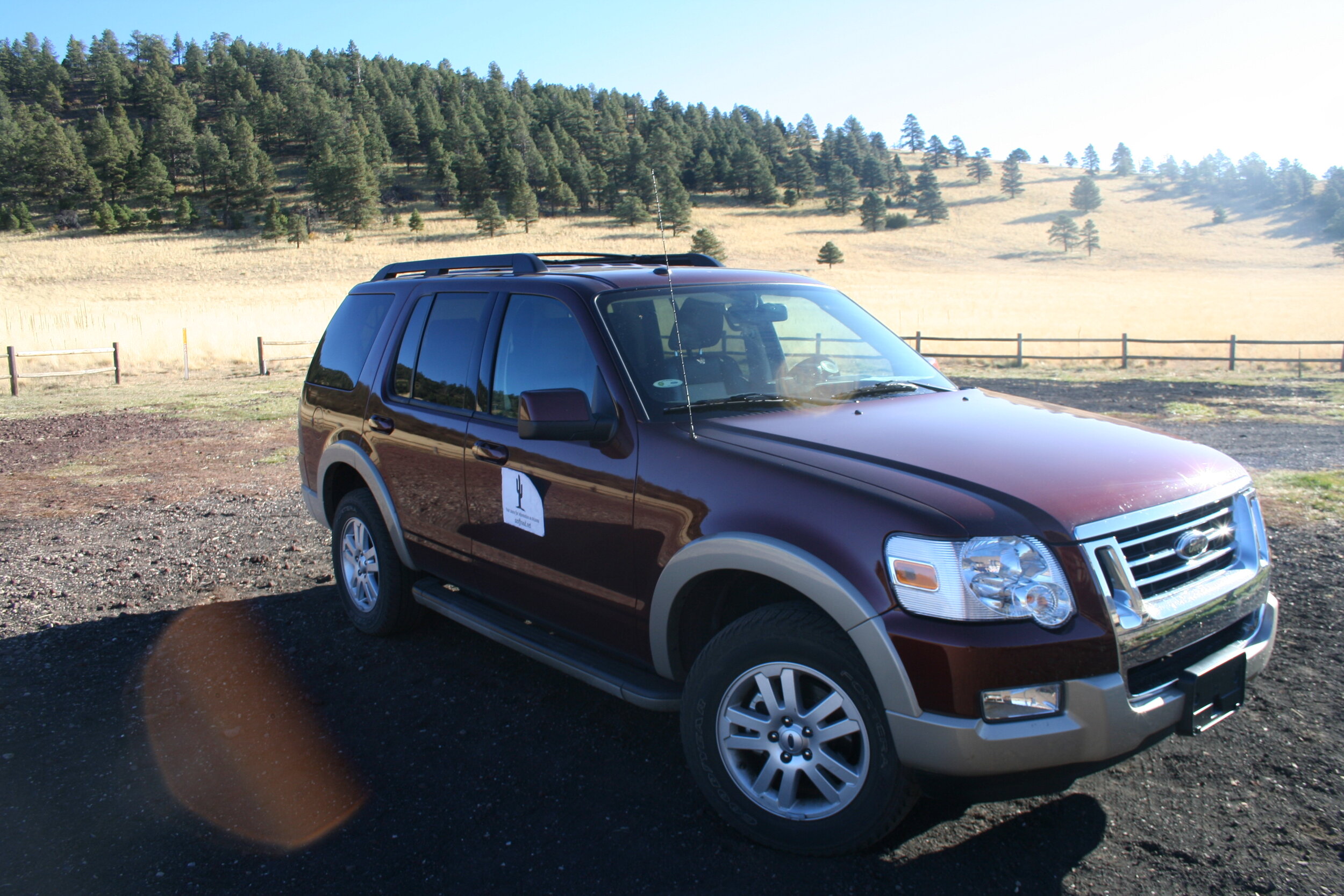
Our trip began on a Friday afternoon. Leaving the Valley of the Sun at about two, we thought we had allowed ourselves plenty of time to reach Kendrick Cabin (our base for the next two nights) before dark. But, some unplanned weekend traffic also heading north for the weekend slowed us down considerably. After some slow and go, we finally got back up to speed just after passing Sunset Point. It was just getting dark after we had arrived in Flagstaff where we stocked up on last minute necessities for the night. The trip was already shaping up to be a great one based on the conversations and mood in the SUV on the way up! After the roughly 3-hour trip up to Flagstaff, we headed north about 15 miles further via Highway 180 (Fort Valley Rd.) to get to our cabin. By the time we got there - it was totally dark. Luckily, we were able to navigate the dirt roads easily and found our cabin rather quickly. We arrived at the cabin at about 9-ish and cooked up a nice stovetop meal - wings and tater tots. We called it a night soon after this, for we knew we had to get an early start to complete what we had planned for the next day.
An early morning view from north of Humphrey’s Peak.
Day 2 — 5:00 AM:
It was a cold morning when we woke up – a chilly 28 degrees. We quickly got together our needed belongings and loaded up the Explorer. We hit the road at roughly 5:15. One of the first things we planned was to take a shortcut over to Highway 185 via Forest Service Roads. This worked out perfect - we were able to watch the sun rise over the high forest plains and we were awed watching the sun hit Humphreys Peak, which was just to our right. After only 45 minutes of dirt roads, we hit pavement and headed north. We passed through Cameron, AZ and turned right onto Highway 161 to continue our journey.
25 miles from Cameron, we made our first stop of the day: Tuba City Dinosaur Tracks. You'll find this turnoff just 5 miles before Tuba City. Since we got there at 7:30, there wasn't anybody there, but, it did look like there were small little market stands. The tracks were hard to find at first, but after looking around, we discovered a walking path outlined by small rocks that lead around the tracks. Most tracks we found were outlined by more rocks. These tracks are from bipedal dinosaurs that roamed around in the area 200 million years ago. The soft mud was perfect to hold the tracks of the dinosaurs that roamed around northern Arizona at the time. The tracks were fairly spread out, but after looking around, you'll be able to find them.
Dinosaur tracks are imprinted in the ground near Tuba City.
The rugged terrain near Tuba City.
‘Elephant Feet’ near Tonalea.
Betatakin Ruins inside of Navajo National Monument.
Continuing on our journey, we continued to head east on Highway 160. We passed through the town of Tuba City until we reached our next turnoff. Along the way we passed by the local attraction, “Elephant Feet” in Tonalea. The two obscure rock pillars are off to the left of the highway just past Tonalea. After passing through the beautiful mountain/forest type terrain near Coal Mine Mesa (just east of Tuba City), we reached Highway 564, the turnoff for Navajo National Monument. After a quick 12 miles, we pulled into the entrance for the National Monument, and we couldn't wait to see what was in store. We headed into the visitors center and set out to the Betatakin Ruins, one of the main highlights of the monument. The other notable one is the impressive Keet Seel Ruins, which are only accessible via a 17 mile roundtrip hike with a ranger. We settled for the quicker and more accessible ruins and set out on the trail. The trail was easy and paved all the way to the overlook, all in all it was a mile round trip hike. It was worth it. The ruins were spectacular and it was amazing to see them hugging the cliff in the midst of a cave, which happened to be located in a beautiful canyon. Betatakin was only occupied from 1250 to 1300, a much quicker period than the larger occupied Keet Seel ruins which were occupied from 950 to 1300. After taking in the great view and taking pictures, we headed back to the visitors center.
After taking the 12 mile road back to Highway 160, we continued to head further east. After 20 miles on Highway 160, we had arrived in Kayenta. Along the way we were treated to more great landscapes including some of the great forested areas along Coal Mine Mesa. Kayenta is a mid-sized town on the Navajo Indian Reservation and is the gateway to the amazing Monument Valley.
After passing through Kayenta for the first time of the day, we headed 25 miles north to Monument Valley. Just before 11:00 A.M., we crossed the Utah border on our way to Monument Valley. Less than a minute later, we took our turnoff, crossing back into Arizona, and finally arriving at the Monument Valley Navajo Tribal Park visitor’s center.
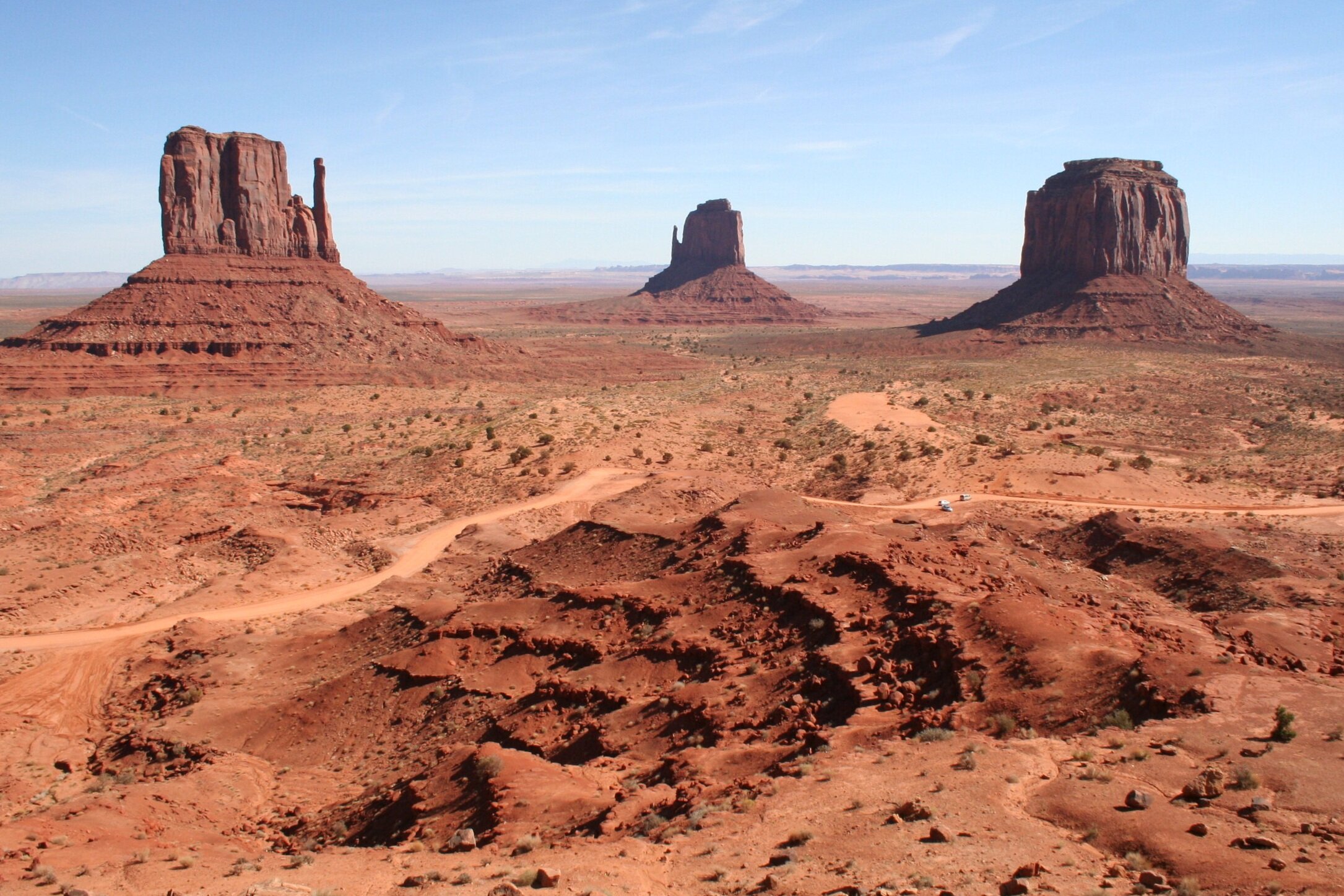
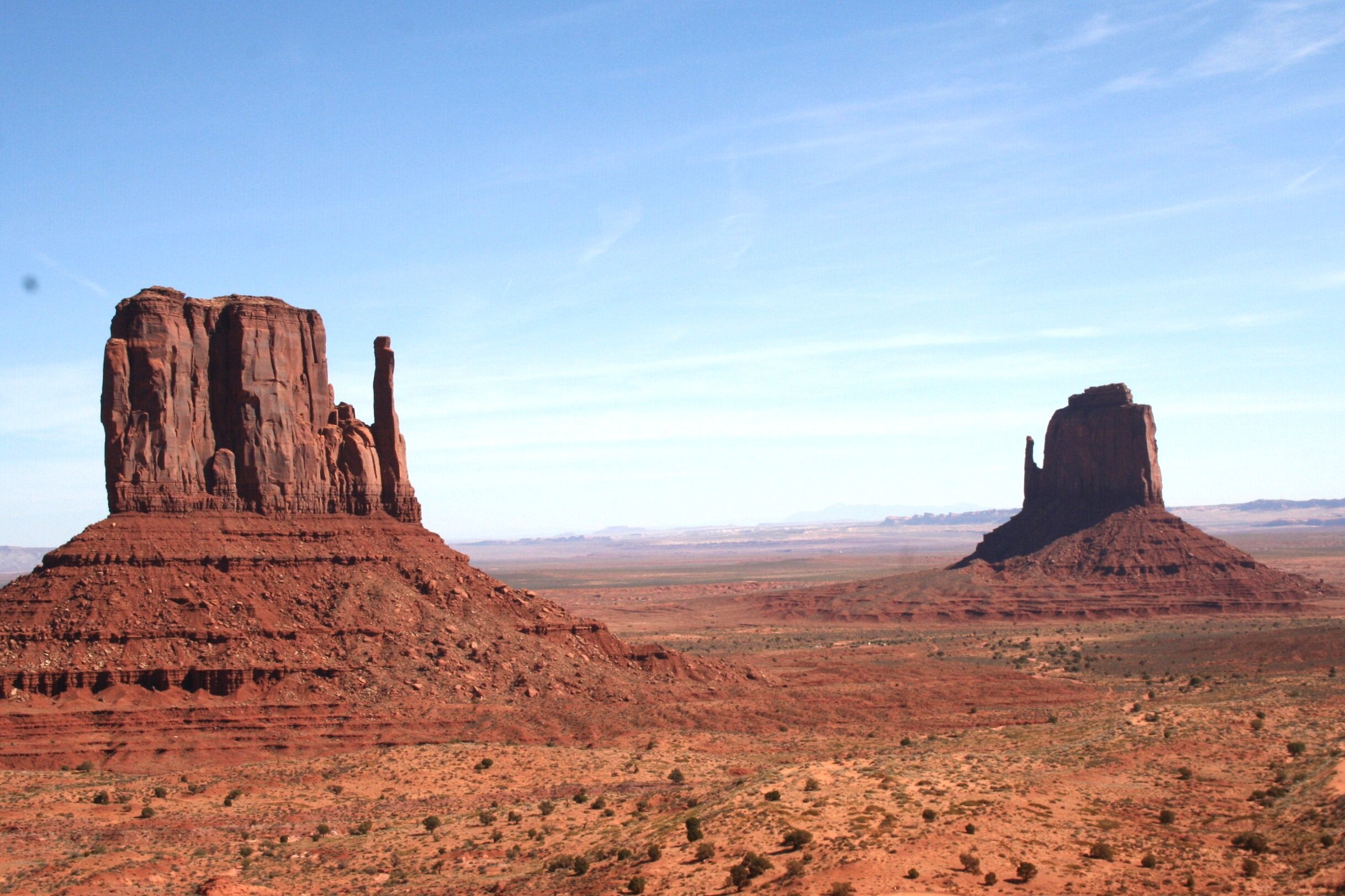
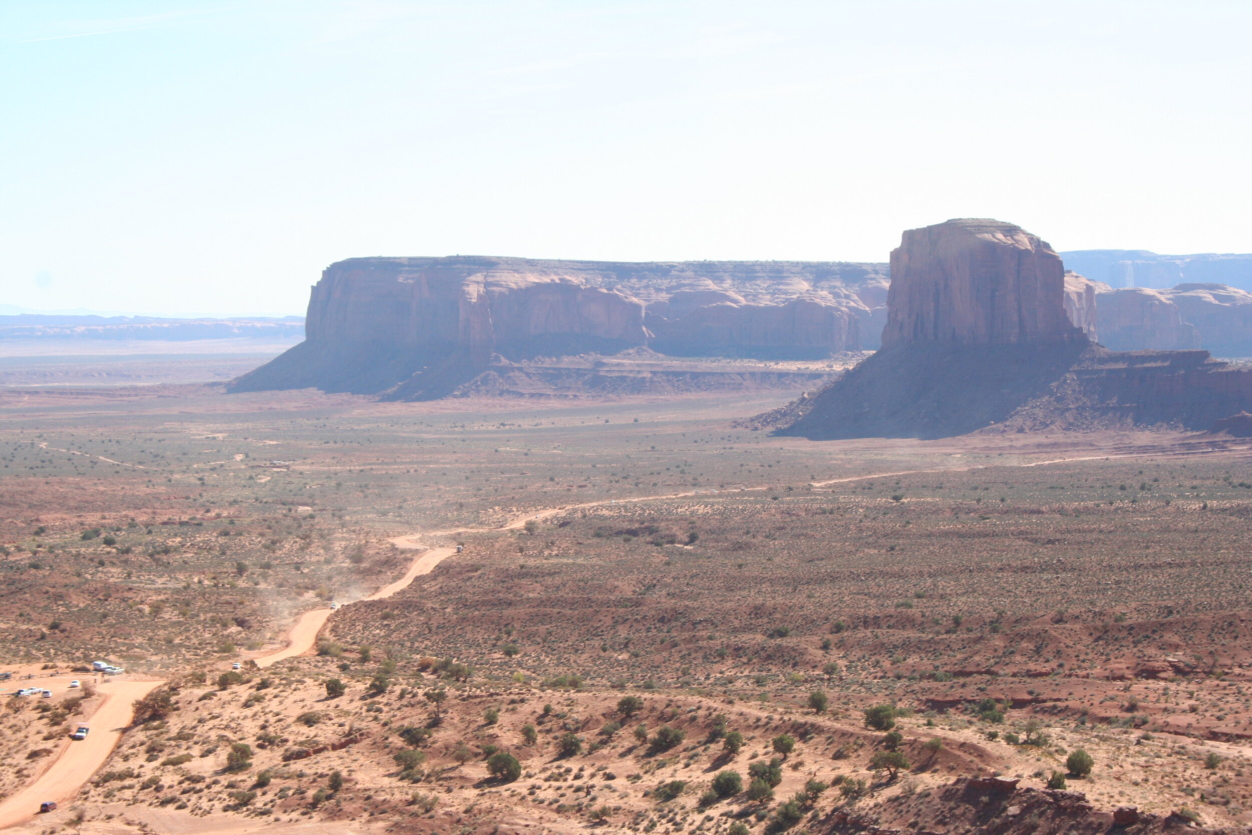
Monument Valley is quite a unique place. Undoubtedly, it is one of the most iconic images of the southwest. The entire area, which is quite broad, covers vast and remote portions of southern Utah and northern Arizona. There is a 17 mile loop road that you can, and if you have the time, should take that loops around the valley. If you choose to do this, make sure you have a high-clearance vehicle. In addition to this road, there is an extensive visitor’s center which houses tons of information about the history of the area as well as a gift shop. Due to our tight schedule, we passed on the road and stuck with the overlook and visitor’s center. We easily could have stayed another 3-4 hours exploring the rest of the park, but we were limited by our schedule.
At this point, we headed 25 miles back to Kayenta where we stopped for a quick bite to eat, topped off on gas and set out for Four Corners. Taking Highway 160 for 70 miles to Teec Nos Pos. Along the way, we passed desolate stretches of land as well as towns like Red Mesa. Another 5 miles down the road, we crossed into New Mexico and took the turnoff for Four Corners. We finally pulled into the monument and with much anticipation, walked over to the actual plaza, which is filled with the monument itself as well as countless Native American vendors. There it was – a collection of flags and the meeting of four states. It was quite a sight and the concept of being able to quickly jump from state to state or stand in all four at once was fascinating. Giant lines in the cement as well as nameplates and flags indicate what state you’re in, without them, you’d have no clue. This is the only point in the entire United States where four states come together at one point, and to be there, was quite a treat. We had done it, we reached the extreme northern and eastern parts of the state.
Four Corners monument in northeastern Arizona.
After about half an hour or so, we got back into the Explorer and headed back down Highway 160 through Teec Nos Pos towards Red Mesa. Our next stop of the trip was Canyon de Chelly in Chinle and there were two ways to get there. One was the 30 mile dirt way, Indian Route 35, or the faster and easier (we discovered later) paved Highway’s 160 and 191. We of course thought the dirt road would be fun so we set out into the desolate looking landscape. It wasn’t long before we lost all traces of civilization. The trail itself wasn’t too bad, it had a few bad ruts and lots of washboard, but all in all it was a nice break from the seemingly endless asphalt we had been on. We always take these back roads whenever we have the chance because, quite frankly, they’re a lot of fun. Although it took longer than the other way (one hour to be exact), we pulled into the town of Rock Point and proceeded to head south on Highway 191. We passed through Rock Point, Round Rock and Many Farms and finally arrived in Chinle after passing through more remarkable looking terrain. It was 4:00 P.M. by the time we arrived in Chinle and we were running out of daylight quickly.
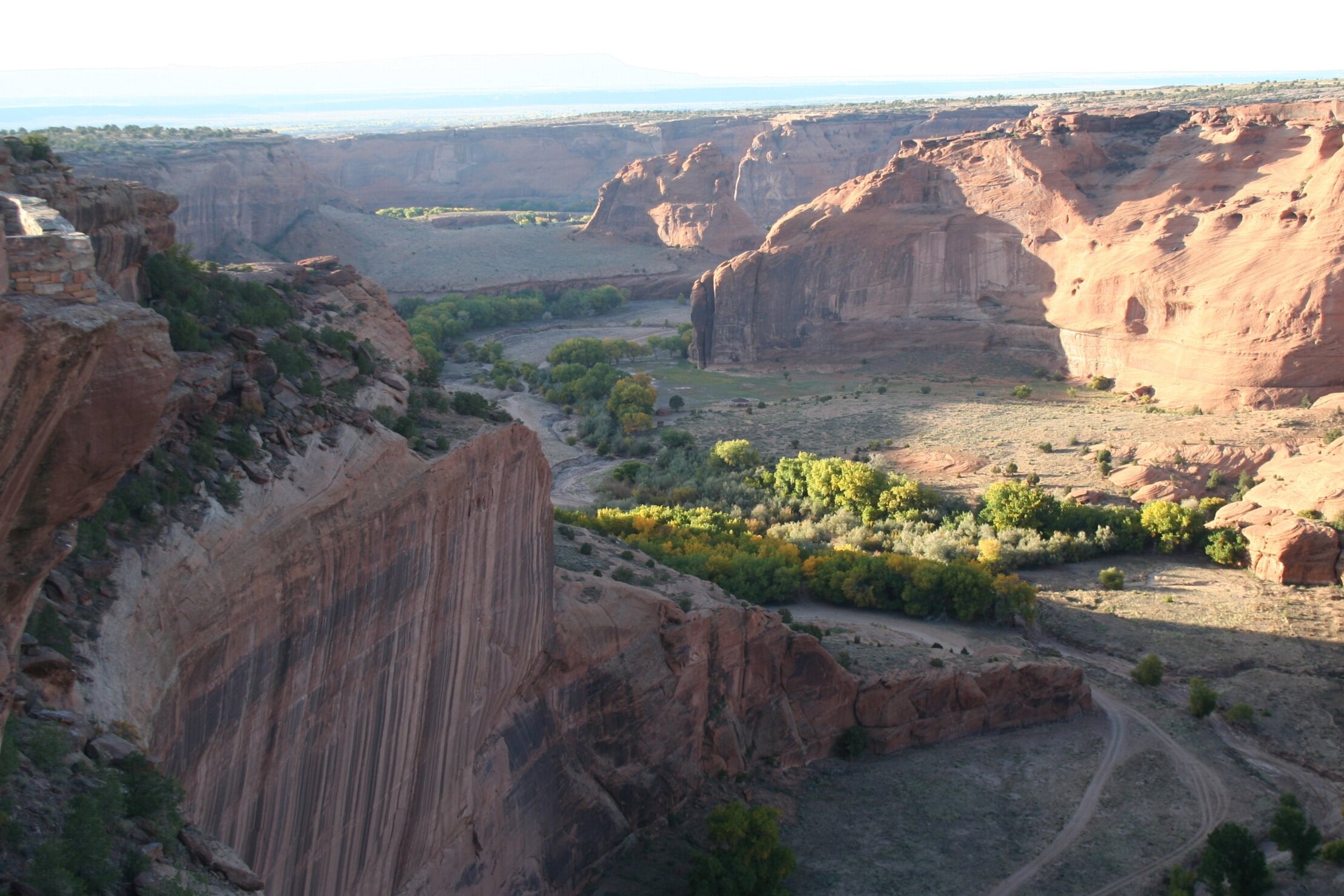
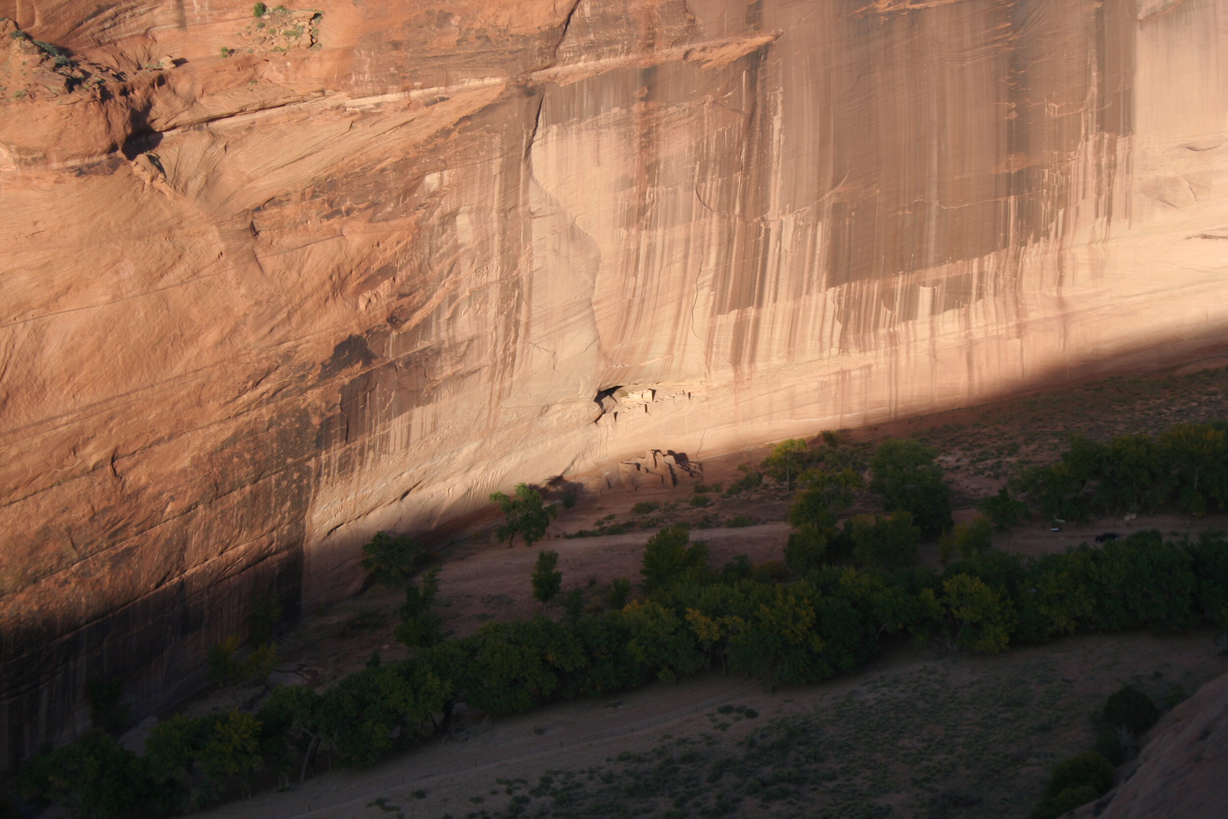
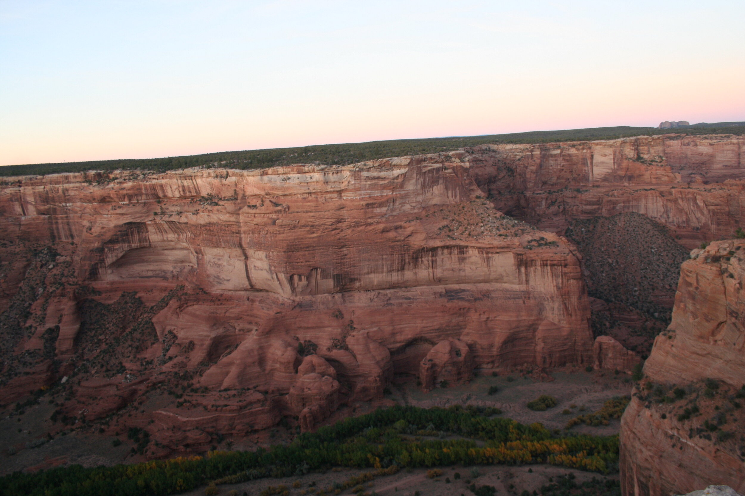
In Chinle, we headed straight for Canyon de Chelly National Monument because we were running short on time. We got to the visitor’s center just before closing time. We headed out on the southern rim road to see what we could see before it got dark, which was just over an hour and a half away. We managed to stop at all the lookouts on the southern portion of the monument and were dazzled by the remarkable views. Stop after stop, we continued to be amazed looking down into the canyon, adorned with high cliff faces, changing tree’s and perhaps most remarkably, the setting sun. This series of stops proved once again to be well worth our time. Be cautious as you explore the lookouts at the Canyon as many have areas where you could easily lose your footing.
By the time we arrived back in Chinle, after 2 ½ hours of exploring the Canyon, it was dark. If we had more time, we had planned on seeing the northern part of the monument, or even hiring a guide and off-roading into the Canyon. Canyon de Chelly National Monument is actually comprised of two canyons: Canyon del Muerto in the north part (which has points like Massacre Cave) and Canyon de Chelly in the south part (which boasts overlooks like Spider Rock and White House Ruins).
We grabbed some dinner and continued to head ever further south to Ganado. After about 45 minutes and 38 miles, we reached Ganado. It was now, way too dark to see anything but we wanted to stop at the historic Hubbell Trading Post National Historic Site for a picture of the sign under the stars. Again, on our next trip up to this region, we plan on seeing this place as well as all the other places we missed due to time constraints.
Matt & Stephen enjoying kielbasa around the fire back at Kendrick.
After another 40 minutes and 35 miles later, we arrived back at I-40, where we would follow this most of the way back to our cabin north of Flagstaff. We refueled in Chambers before getting on the interstate. It was a long drive and with it being dark, we were forced to engage in conversations and talk about our day’s adventures to keep things interesting. After passing through the small towns of Holbrook and Winslow, we arrived back in Flagstaff two hours later. We pulled into the cabin after taking Fort Valley Road north, 150 miles from out last stop. Although it was about 11:00 P.M. when we arrived back at Kendrick Cabin, it was just minutes after we had anticipated in the planning stages of our trip. We decided to get a fire going and we enjoyed s’mores and smoked kielbasa as we sat out in the cold outside of our cabin. Again, this was another great experience, looking up at the bright night sky, clinging to the nice warm fire to keep warm and having more great conversations with each other. At this point, after a very long day, we decided to call it quits and head to bed for the night. This day had marked the most traveled day on our records; we had covered 672 miles and seen so many incredible things.
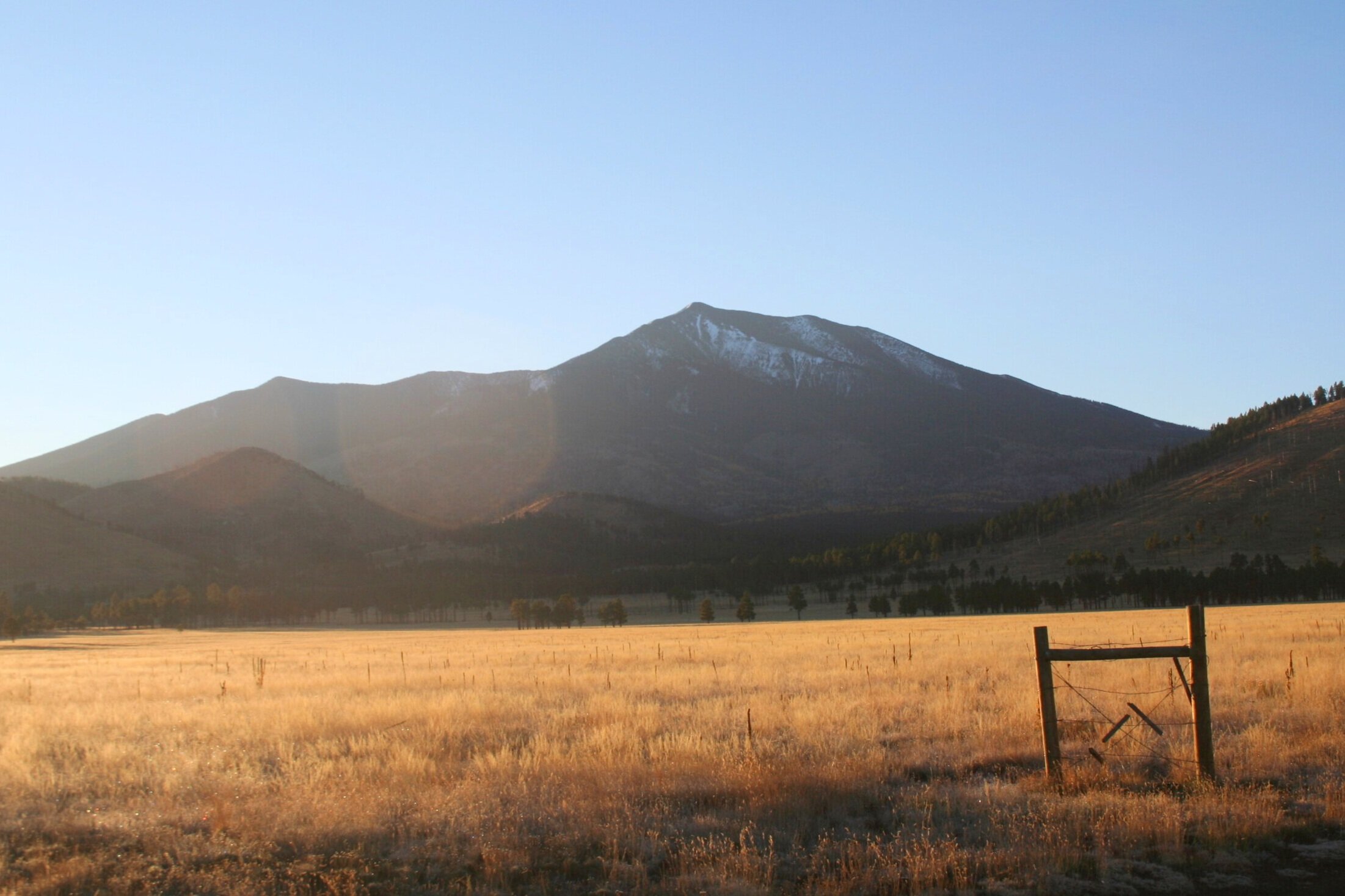
We awoke early the next morning and Scotty and Daniel headed out early to check out the new landscape, since this was the first time we had seen the cabin in daylight. The view was spectacular; open fields surrounded by tall pine trees, with the snow-capped San Francisco Peaks looming like what seemed just a mile or two away. After a nice home-cooked breakfast, we cleaned up the cabin, packed up all our belongings into the Explorer and set out for Flagstaff.
Day 3:
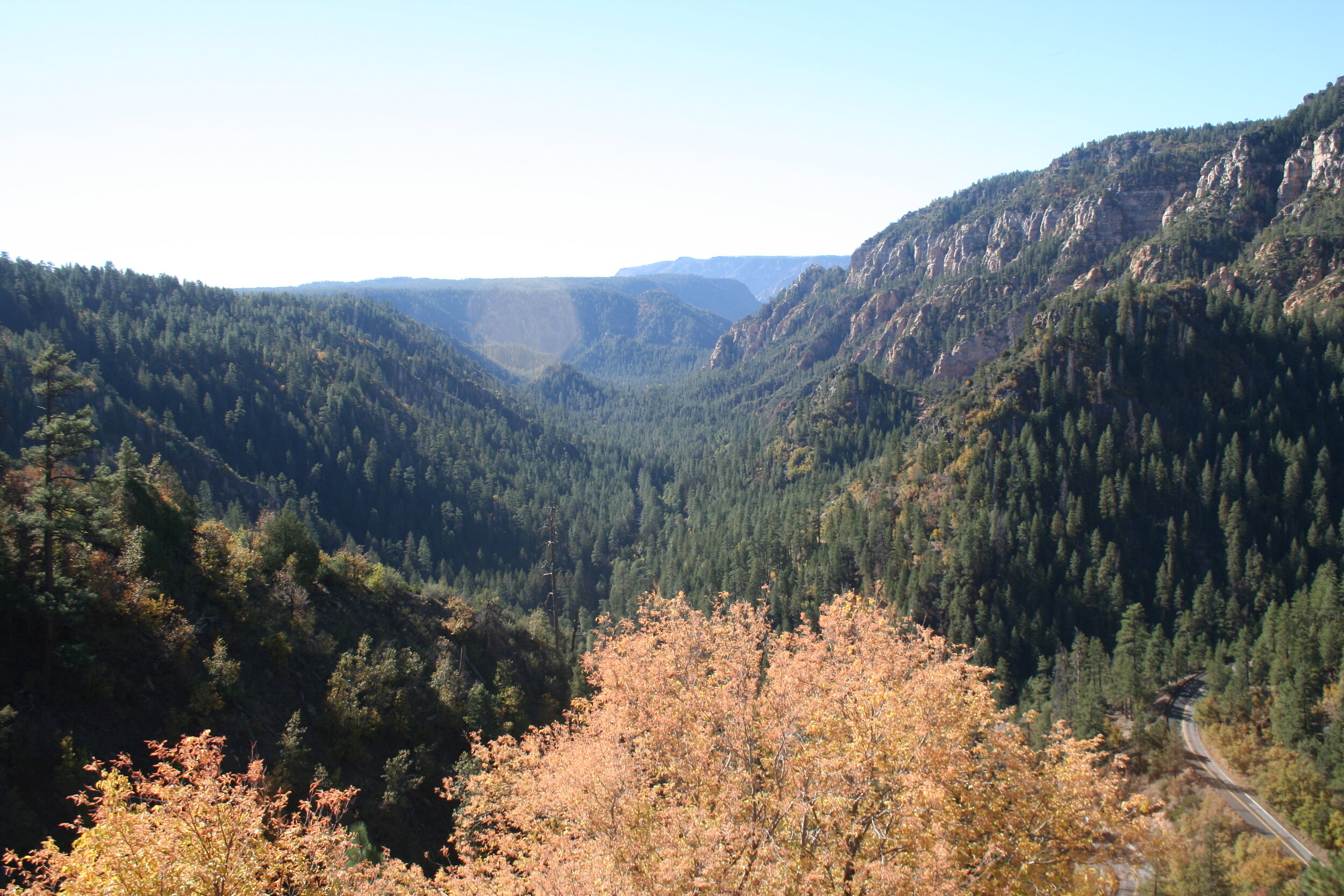
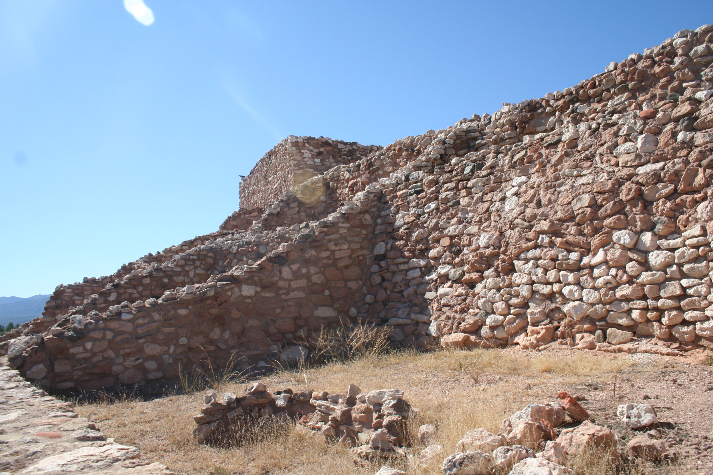
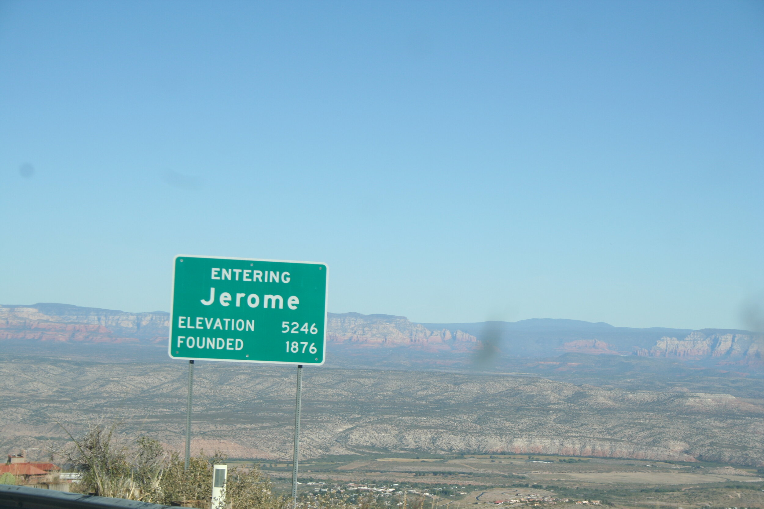
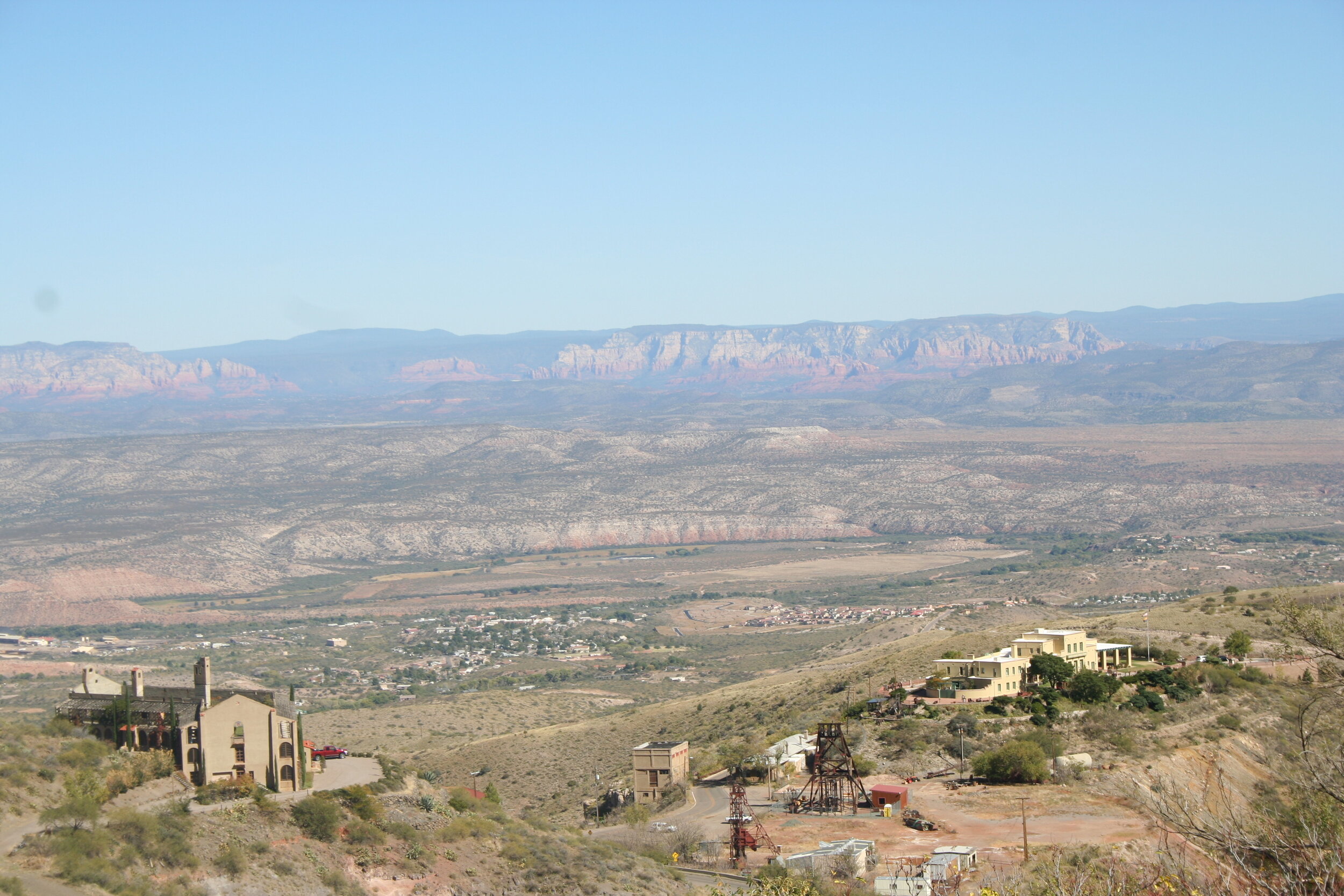
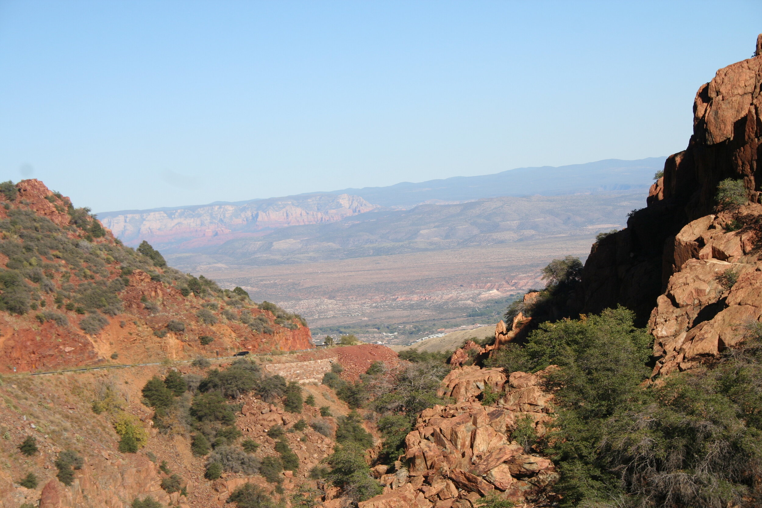
We took the ever beautiful drive down Highway 89A through Oak Creek Canyon. After a bit of sight-seeing in Sedona, we continued to head south to Clarkdale. We made a stop at Tuzigoot National Monument again and enjoyed walking among ancient Sinagua Indian ruins. Looming in the distance and hanging to the side of a cliff was the town of Jerome, our 3rd stop of the day. After the 6 mile drive to Jerome, we searched all over for a parking place (Jerome is a very popular place, especially on the weekends) and after finding one, grabbed it. We headed into the town of Jerome, grabbing some lunch at Bobby D’s. The food in Jerome has always been good, and this time was no different. We made a couple of other new stops in Jerome, including one at the Jerome Historical Society’s mine museum. This museum has a neat collection of some mining artifacts that tell the story of Jerome. This little but informative museum was a great place to learn about the entire history of Jerome.
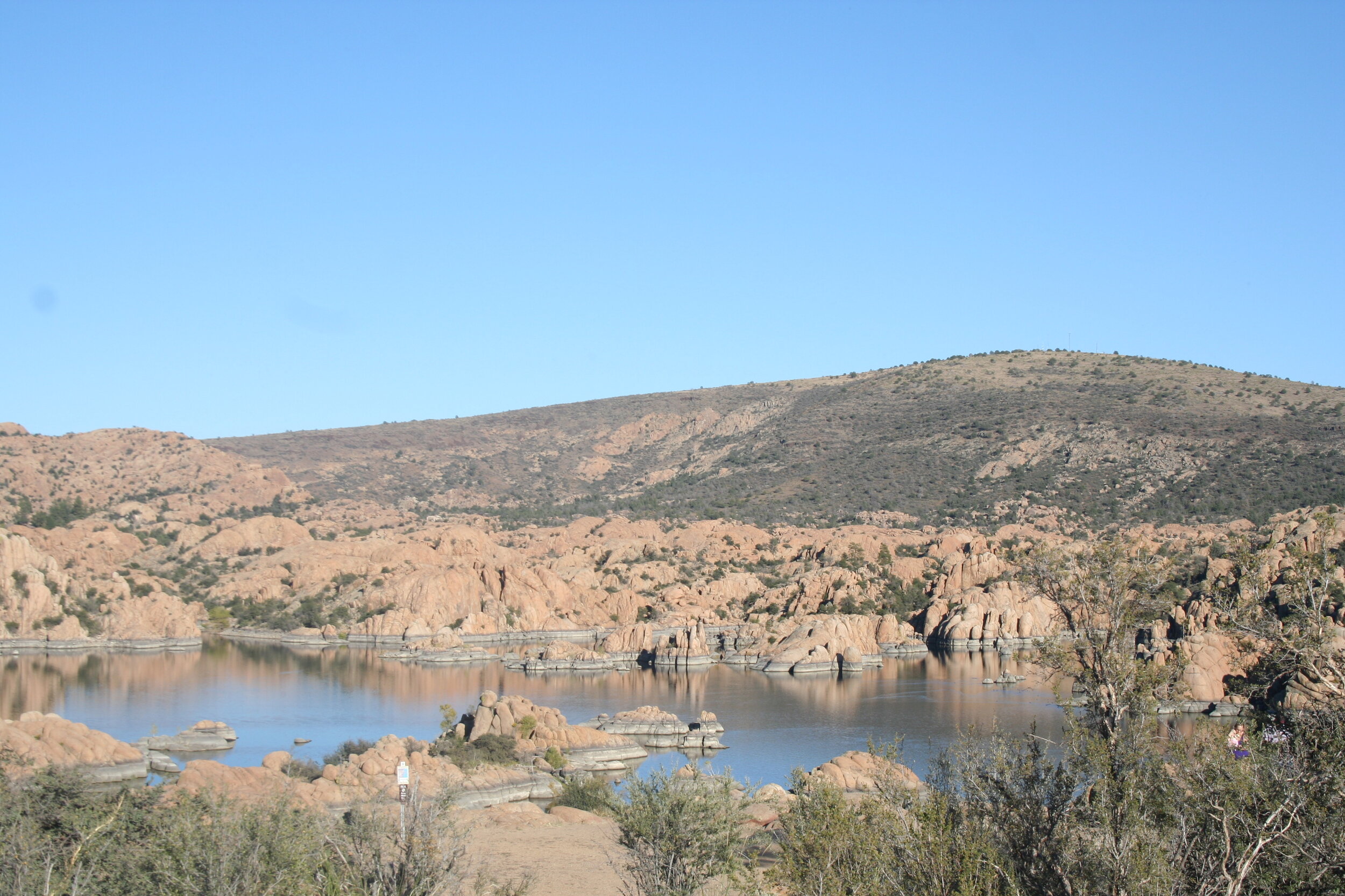
After about 3 hours in Jerome, we were forced to continue on our journey back home. The drive from Jerome to Prescott was thrilling as we drove around sharp turns, over steep grades and finally, after 30 miles, we arrived in Prescott. At this point, we were running behind schedule and had to make the official decision to call off our plans of returning to the valley via Stanton and Wickenburg. Instead, we made a quick stop at Watson Lake and headed east on Highway 69 through Dewey and Mayer. We jumped back onto I-17 at about 4:45 P.M. From here, it was only another hour and a half to get back home and like the rest of the trip before it, flew by. We finally pulled back into Avondale at about 6:15 P.M.
This trip, while it was very crammed and rushed, was one to never forget. We accomplished our original goals of seeing new places and reaching the furthest reaches of the state. All in all, we covered an astonishing 1,080 miles, a new record for a two and half day trip. Things to consider when planning a similar “big trip” like this would be to take it slow. There were a lot of stops we could have taken that we did not have time for, we basically hit all the “big” and “popular” places. Nevertheless, this trip was incredible and we enjoyed conquering north-eastern Arizona.


