Arizona Strip Trip - 2017
Our 5 day journey through Arizona's most remote backcountry
Our track from the Arizona Strip Trip (click to enlarge photos)
The Arizona Strip is that area in the very northern part of the state above the Grand Canyon along the border of Utah. It is 200 miles long and accessed only by two major highways on either end. Because of its lack of an easy access, the Strip remains one of the most remote and least-visited parts of the state. Only about 8,000 people call this region, which is the size of the state of Massachusetts, home. With endless dirt roads, numerous scenic and historic sites, and lack of easy access, we figured the Arizona Strip was a perfect setting for our big summer trip this year.
Our trip would be 6 days long with our last night spent in Las Vegas. The total journey would take us over 1,000 miles across the Arizona strip from just west of Page, Arizona to end in Las Vegas, Nevada. Of course, along the way, we’d be treated to some of the most incredible sights in Arizona, and across the southwest. In our five days on the Strip, we’d visit White Pocket in the Vermillion Cliffs, the North Rim of the Grand Canyon, Toroweap, the historic Mt. Trumbull Schoolhouse and Grand Gulch Mine and many other scenic trails.
Day 1:
The trip began with a long and uneventful 4 ½ hour drive north from Phoenix. We topped off the gas in Marble Canyon on Highway 89A and proceeded west to House Rock Road where we turned off the highway. After airing down, we set out north. The trail remained wide and relatively smooth as we paralleled the scenic Vermillion Cliffs. The Vermillion Cliffs is a raised plateau that is part of the intricate Grand Staircase across the southwest. The interesting geology, which includes ancient dunes, makes it a destination for numerous outdoor adventurers, photographers, and off-road enthusiasts.
After 9 miles, we turned off the easier House Rock Road and began to head east on BLM 1017 up and into the Vermillion Cliffs themselves. We crossed into the National Monument, which unfortunately, is a no-fly zone. From here, it was 15 more miles to our overnight stop. The road quickly climbed up a less-pronounced section of the cliffs and leveled off. On top of the plateau, the road got rougher. Several sections of exposed rocks mingled with long sections of deep and fine sand.
Airing down the first time in the Vermillion Cliffs.
Gate along the sandy trail to White Pocket.
After several miles, we passed through an old ranch lined with old corrals, vehicles, and a couple of buildings that are still inhabited. The trail turned left onto BLM 1087 and headed north as things continued to get rougher. Despite the deep sand and the weighted down vehicle, we were able to continue in 2-wheel drive. We passed through an old gate and began to see signs that we were approaching our destination. Scenic rock formations jutted out of the sandy, desert floor and after a long and bumpy road, we arrived at our destination.
We were now at White Pocket and it felt like we had stepped into another world. After 25 miles of moderately challenging off-road driving and nearly 5 hours of highway driving from Phoenix, our efforts for the day had paid off. We were beginning our Arizona Strip trip at one of the most spectacular places either one of us had ever been to. It was just after 6:00 P.M. when we arrived, and we immediately set out to investigate. White Pocket consists of bizarre rock formations with “pockets” of bleached white sandstone that overlays different waves and coves of traditional red sandstone and other rock units. The forces of nature over millions of years sculpted this truly bizarre landscape into what it is today.
The stunning formation of White Pocket.
Walking around White Pocket, you will find new things to look at around every corner.
We made camp just a few hundred feet east of White Pocket. When we got out of the Jeep, we found ourselves in super-fine sand where even walking was slightly challenging. We unpacked the Jeep and quickly got the tent set up and air mattresses inflated. We set up our cooking station where we would begin on dinner very soon. We weren’t the only ones here at this remote spot. White Pocket has gained increasing popularity with photographers and tour groups who aren’t able to access the nearby Coyote Buttes also in the Vermillion cliffs.
As the sun set over this scenic area, we lit the propane stove. Tonight’s dinner would be a good one – steak, mashed potatoes, and corn on the cob. Daniel set to work on dinner as I headed out to explore the area some more. About an hour later, dinner was served and oh boy, was it pretty great. After a long day on the road, we sat in our camp chairs and enjoyed the dimly lit scenery here just a couple miles south of the Utah border. Even though we began our Arizona Strip trip by heading the wrong direction, the payoff was certainly worth it.
After doing dishes and cleaning up camp, we sat in the darkness under the blanket of stars. We continued talking as we un-winded. Just before midnight, we crawled into the tent and settled in for a long-awaited night’s sleep. Tomorrow would be a busy day and we still had 4 days and many more miles of the Arizona Strip to cover.
Daniel leading the first night's cooking operation.
Night #1 Dinner: Steak & mashed potatoes with corn and beer!
Nightlapse from White Pocket.
Day 2:
After a cold but restful night, I was up just after sunrise. I immediately set out towards White Pocket to continue exploring. The area was already crawling with other tourists who had made the morning trek out. Luckily, because White Pocket is so spread out, I found myself alone as I walked around. Small puddles of water remained from a recent storm and around every corner lay a new feature to check out. Long sections of pillow-like white rock draped the area. Small imprints lay on the surface. Steep sections of red and white sandstone intermingled along some of the drop offs. Small sand dunes and vegetation interjected into the alien landscape. After nearly two hours of walking around, I finally made it back to our camp where Daniel was just getting up. His air mattress had deflated during the night, but the soft sand we camped on meant that it had been a decent night for both of us.
Exploring White Pocket the next morning.
White Pocket does not disappoint.
We broke down what was left of camp and loaded up the Jeep. We sat for a few more minutes, overlooking White Pocket, as we enjoyed a simple and quick breakfast of donuts. We hopped in the Jeep to begin another day of the Arizona Strip Trip.
We re-traced our route 15 miles from White Pocket to House Rock Road. The trail was still bumpy and rough, but we had no trouble whatsoever. Once back on House Rock Road, we headed south for about 9 miles, before airing back up. Of course, the air-compressor was buried in the absolute most inconvenient place in the back of the Jeep.
Not long after airing up, we jumped back onto AZ-89A and headed west. Immediately, the road began a rapid climb and it twisted and turned towards Jacob Lake. Just a few minutes later, we continued south on Highway 67 towards Grand Canyon National Park. The road south climbed through wide green meadows as we approached 9,000 feet in elevation. Signs told us to watch for bison and a small amount of snow remained in some of the forests’ shadows.
Preparing to air up for a short pavement section after the Vermillion Cliffs.
Heading south at 9,000' along Highway 67.
The view from the North Rim.
The seasonal trail closure for Point Sublime wasn't quite over when we arrived.
Last ressuply point (North Rim Country Store) for the next 24 hours.
About 40 miles later, we arrived in Grand Canyon National Park. We headed south to the visitor center and overlook where we made a quick stop to check out the view. The North Rim is 2,000 feet higher than the South Rim, and even though they are only 10 miles apart, nearly 200 miles of road separates them. Not wasting too much time, we headed back north. We wanted to hit a trail that would take us out to one of the best overlooks in the park – Point Sublime. Unfortunately, just a few miles in, we found the trail gated off and closed. Not knowing why, we were forced to turn around and come up with a different plan.
It was about 2:00 P.M. when we topped of our gas tank just a few miles north of the National Park at the North Rim Country store. It was there that we learned that Point Sublime Trail was closed due to numerous downed trees and there was no way to get to the overlook at this time. Since the area is only open after May 15th, our trip early in the season meant that not all the trails had been cleared yet from the past winter. After consulting the locals and a map of the area, we decided to head for Fire Point to the west of Highway 67.
We headed back south briefly and turned west onto forest roads. We would follow these for about 20 miles until we reached the overlook. We aired down, but luckily for us, things remained relatively smooth and quick moving. The trail passes through several high-elevation sections and Aspen trees and cool air greeted us as we moved along.
At about 4:00 P.M., we crossed a cattle guard and the trail got rougher. The trees on either side of the trail were narrow and our pace was slowed. Up ahead was a mud puddle and as soon as we went through it, we discovered it was much deeper than expected. We kicked it into 4WD as we slowly trudged through the deep puddle. The Jeep was now caked in a solid layer of mud from the windows down. Not long after, we arrived at Fire Point. The overlook looks west into the vast expanse that is the Grand Canyon.
Heading into the forest towards Fire Point.
The incredible view from Fire Point.
We took this scenic opportunity to break for a late lunch. We made sandwiches and enjoyed some down-time on the rim of the Canyon. However, it was getting late in the day and we still needed to cover about 25 miles of forest roads before our overnight stop. From Fire Point, we continued east for a few miles and then headed north. The windy forest roads were quite scenic. Numerous downed trees all along the road were evidence that this area really can be inaccessible depending on the time of year you come out.
We hopped on the fast-moving Forest Road 22 for a few miles and made up some time. A few minutes later, we turned off onto 447. The last 15 miles would be rougher and slower. The trail twisted and turned and eventually we found ourselves at the intersection of 423, just a mile from our cabin. Just after 6:30 P.M. we arrived at Jumpup Cabin at the end of the road. This historic cabin was built in the early 1900s and was used by early ranchers and later by forest rangers. The cabin is available for rent and has access to hiking trails and other off-road trails in the area. We were pleasantly surprised with the cabin’s facilities – two small rooms, a fire ring, and an open-air composting toilet.
This single mud puddle is responsible for 100% of the mud on the Jeep for the entire trip.
Luckily, tonight we wouldn’t have to set up the tent, the camp box, or anything really. We unloaded our essentials and quickly got a fire going as the sun set. Tonight’s dinner would be a simple one, but an old favorite – fire-roasted kielbasa with cheese-whiz. What a beautiful thing. We chowed down as we sat around the campfire. Once again, the night-sky was impressive. With no towns of any size anywhere nearby, we were truly on our own out here.
We called it at around 11:30 P.M. and retreated inside of the rustic cabin for the night. It would be nice to have a roof over our heads and an actual mattress to sleep on before another two nights of camping. We slept like babies.
Inside our accommodations for the night: Jumpup Cabin.
The facilities are rustic, but they're better than nothing.
Jumpup Cabin at night.
Day 3:
After an incredible night of sleep, we awoke the next morning well-rested. We took advantage of the nearby facilities and scarfed down a quick breakfast. After walking around the cabin to check things out in the daylight, we then worked to clean things up and load up the Jeep once again. After a quick visit by a local ranger, we departed the cabin.
The next morning at the cabin.
5-way intersection at Jumpup Divide. South leads to cabin and overlook, north leads to Fredonia.
We headed north a few miles and made a hard left onto Forest Road 201 at Jumpup Divide. From here, it would be 10 miles of rough trail to get to the scenic Jumpup Point. The trail didn’t disappoint. With several washouts, lots of rock ledges, and narrow sections, we crawled south toward the overlook. Eventually the road let up and leveled off. The views immediately improved as we drove along the edge of the cliff. Shortly thereafter, the trail dead ended – literally – at the edge of the Grand Canyon. Before us was a tremendous drop-off and an impressive overlook of the intersection of Jumpup Canyon and the Grand Canyon.
The trail to Jumpup Overlook has amazing views into the Grand Canyon along the way.
Looking south from Jumpup Overlook.
We're not sure why it's called "Jumpup", but that's exactly what we did.
We approached the edge and looked down into the chasm. The Colorado River loomed deep below and incredible rock formations surrounded us on three sides. We let our nerves settle down and took an obligatory “jump-up” picture at Jumpup Overlook. We headed back north 10 rough miles and returned to Jumpup Divide.
At the intersection, we continued straight onto Forest road 236 and headed towards Fredonia. The drive smoothed out and was really beautiful as we wound through scenic canyons and wilderness areas. After 25 miles, we aired up yet again as we arrived back on pavement. Just a few miles later we rolled into the town of Fredonia.
We topped off the Jeep and filled 2 additional 5-gallon gas cans with extra fuel and topped off the ice in the coolers. Fredonia was founded in the late 1800’s and serves as one of the largest towns on the Arizona Strip with a population of just over 1,000 people. For some strange reason, they have no grocery store though, and we were forced to make the quick jaunt into Kanab, Utah to get a few essentials for tonight’s dinner.
Within half an hour, we were back in Fredonia, and headed west on AZ-389 for just 8 miles to the turnoff for Toroweap. Toroweap lies 60 miles south of the highway and remains one of the most remote yet most photographed viewpoints of the Grand Canyon. We aired down and prepared for the long road ahead. From here, we wouldn’t see pavement for nearly 48 hours and over 200 miles down the trail.
We headed south on the long and straight BLM Route 109. The road was generally fast moving with long stretches of washboards. The further south we headed, the better the views got. After about 35 miles, the road began to wind and climb. Shortly after, we entered Grand Canyon-Parashant National Monument. The views continued to improve as we drove through a wide valley with cliffs on one side and a mountain range on the other.
Scenic canyons in the wilderness just south of Fredonia.
Fredonia would be our last resupply point until Nevada, so we needed to top off both gas cans and coolers.
Turnoff for Toroweap.
We checked in with the ranger at the 55-mile mark as we blazed through the Greater Tuweep Metropolitan Area. The road got instantly rougher as we crawled along the final few miles. We grabbed a campsite and immediately set up camp. It was just before 7:00 P.M. and we decided to drive the final mile to the overlook to catch the sunset. After an even rougher 4WD trail, we finally made it to the viewpoint at the end of the trail. Here, a 3,000-foot drop greets those looking into the canyon. It is here where the Grand Canyon is the narrowest. The Colorado River thunders nearly a mile below and the views are simply breathtaking.
After enjoying the viewpoint, we headed back to the campground where we got started on dinner. Tonight – chicken stir-fry and rice. And it was absolutely delicious. The campsites at Toroweap require a permit from the Park Service and chances are you will be joined by numerous others who made the drive as well. The campground is quite nice and has many great spots and two bathrooms. We called it an early night and headed to bed at around 11:00.
Heading south along scenic cliffs towards Toroweap.
Road grading equipment, no wonder the road is so bumpy.
The view from Toroweap is nothing short of jaw-dropping.
Night #3 dinner - stir-fry and beer!
Day 4:
After another night on the ground, we were up early. We scouted out the surrounding area which was full of impressive views. We had time for an actual decent breakfast and whipped up some eggs and sausage on the stove. Not long after, we were packed up and on the road. Today was gonna be a long day, with about 140 miles planned, all of which were off-road.
After leaving the National Park, we turned west and began a rapid climb up Mt. Trumbull. The road remained rough and bumpy, but the miles passed quickly. Near the summit of Mt. Trumbull we stopped at an historical marker. We were now at the Sawmill Historic Site, one of the earliest and most productive lumber mill sites on the Arizona Strip. This site in particular was operated and used to create timbers for the nearby Mormon Temple in St. George, Utah. Little remains of the mill site today.
Camping spot at Toroweap. Most sites were filled. (Permit/Fee Required ahead of time)
Leaving Toroweap the next morning. The road has several sections of nice boulders and rock ledges.
We continued west and almost immediately began our descent back down Mt. Trumbull into the Upper Hurricane Valley. The road got rougher again but before we knew it, we had arrived at a major intersection with a small white building off to our right. We were now at the historic Mt. Trumbull Schoolhouse, named for the nearby mountain we had just driven over. Originally built in 1918, the Schoolhouse was used for church, town hall meetings, and obviously school for the residents that lived in the surrounding valley. It was founded by early Mormon pioneers and homesteaders who lived and worked in this extremely remote area. Perhaps the most notable family that lived nearby was the Bundy family. The school operated until the 1960’s when the population dwindled. The building was burned down by arsonists in the early 1990’s but has since been rebuilt to serve as a testament to the history of the area.
Mt. Trumbull Schoolhouse deep in the Arizona Strip.
Inside the beautifully restored schoolhouse.
We walked around inside and out of the building. Numerous artifacts remain scattered around the property, and it is truly worth the stop if you’re in the area. After our visit, we continued west onto unimproved roads and back into the Grand Canyon-Parashant National Monument. The roads got rougher again and our pace was slowed for the next 20 miles.
After a brief detour on the wrong road, we finally made it to BLM Road 103 by about 2:30 P.M. Our campsite for the night was to the right, but there was something to the left that I really wanted to see. A brief stint of fast moving road was followed by another section of slow and go. For 15 miles, we crawled through washed out river bottoms, scenic canyons and finally into the Grand Wash Cliffs. By around 4:00 P.M. we finally made it to our destination – Grand Gulch Mine.


Driving through the heart of the Grand Canyon-Parashant National Monument.
Grand Gulch Mine is an historic copper mine that sits at the base of the scenic Grand Wash Cliffs. The mine opened around 1878 and was one of the more productive mines in the area. Copper ore was pulled out of the ground and transported to a railhead over 400 miles away to Salt Lake City. The mine was considered to be one of the richest copper lodes in the Arizona Territory, but its lack of easy access meant its success would be tainted. At its peak in the early 1900’s, about 80 people lived here. The mine was shut down for nearly 20 years following WWI when prices plummeted. It reopened during WWII and large trucks were used to haul out ore. The mine was closed down in 1958 following a fire and steady drop off of mineral wealth.
Today, the old bunkhouse, mine headquarters, two original dump trucks, and several other foundations remain. It is fascinating to see the site left in its nearly original shape following its demise. However, it was now getting late in the day and we still had a 15-mile drive back out to the main road and there were still over 60 miles to get to our campsite.
Driving into the night on (not) smooth BLM roads.
We retraced the rough 15 miles through Upper Grand Wash Cliffs and ultimately ended up back on BLM Route 103. We headed north for several miles until reaching Route 1003. The road swung west and headed into Hidden Canyon. Things got rougher and slower as we crawled along the wash bottom. We passed through a section of Joshua Trees and the stark beauty of the region was really something. It was around 6:30 when we had cleared the canyon and began our climb out. Things got rougher still. According to the BLM map of the National Monument, we only had 3 more miles of rough stuff. As it turns out, those three miles would take nearly an hour.
We crawled along in 4WD along the edge of the cliff as steep drop-offs and large boulders meant that we could – literally – only go a few miles an hour or risk breaking something on the Jeep and getting stuck. It was around sunset (7:30 P.M.) when we cleared the shelf road and were back on flatter ground. There was still a problem, however. The road wasn’t any smoother.
For the next 25 miles, we crawled along. Through canyon after canyon and numerous creek bottoms, it was slow and go as the hours rolled by. Fortunately, the Jeep had plenty of lights to illuminate the trail. Our frustration mounted as we continued the agonizing drive. We finally made it onto Route 242 and suddenly began a rapid climb. We were now in the Virgin Mountains. Our campsite was just a few miles ahead. We crested the pass and exited out of the Grand Canyon-Parashant National Monument. Of course, as if things weren’t bad enough, we lost our GPS in the center console in the small hole where the e-brake is, so we now didn’t know exactly where our campsite was.
Eventually, we began our descent and found the campsite. The only problem was because it was so late, someone had already claimed it. We continued down the mountain and ultimately found a nice spot a couple miles down the road. It was now 10:30 P.M. and we had been driving for a solid 12 hours. Upset and absolutely done for the day, we set up our tent in the dark. We quickly got a fire going. Tonight’s dinner was supposed to be a re-try of the chili and cornbread we messed up last year on El Camino, but because it was so late, we resorted to kielbasa leftovers and copious amounts of alcohol.
Setting up camp in the dark. Luckily we had plenty of lights.
After 12 hours on the trail, it was nice to stop for the night.
Day 5:
Our campsite near the scenic Lime Kiln canyon.
After a long and grueling day yesterday, we were looking forward to waking up late. However, since we camped just a few yards off a major road into Lime Kiln Canyon, that wasn’t going to happen. We stumbled out of the tent and were pleasantly surprised by the impressive view. It was around 7:30 A.M. and we were sitting around the cold campfire, when a trailer pulled up and we heard commotion.
Across the canyon, we saw what was happening. A rancher was on horseback trying to round up some rogue cattle that had been wandering up the canyon. His wife parked their trailer on the road in hopes of taking them back to their ranch. Unfortunately, I don’t think they got them herded into the trailer. We broke down camp and loaded the Jeep up one last time.
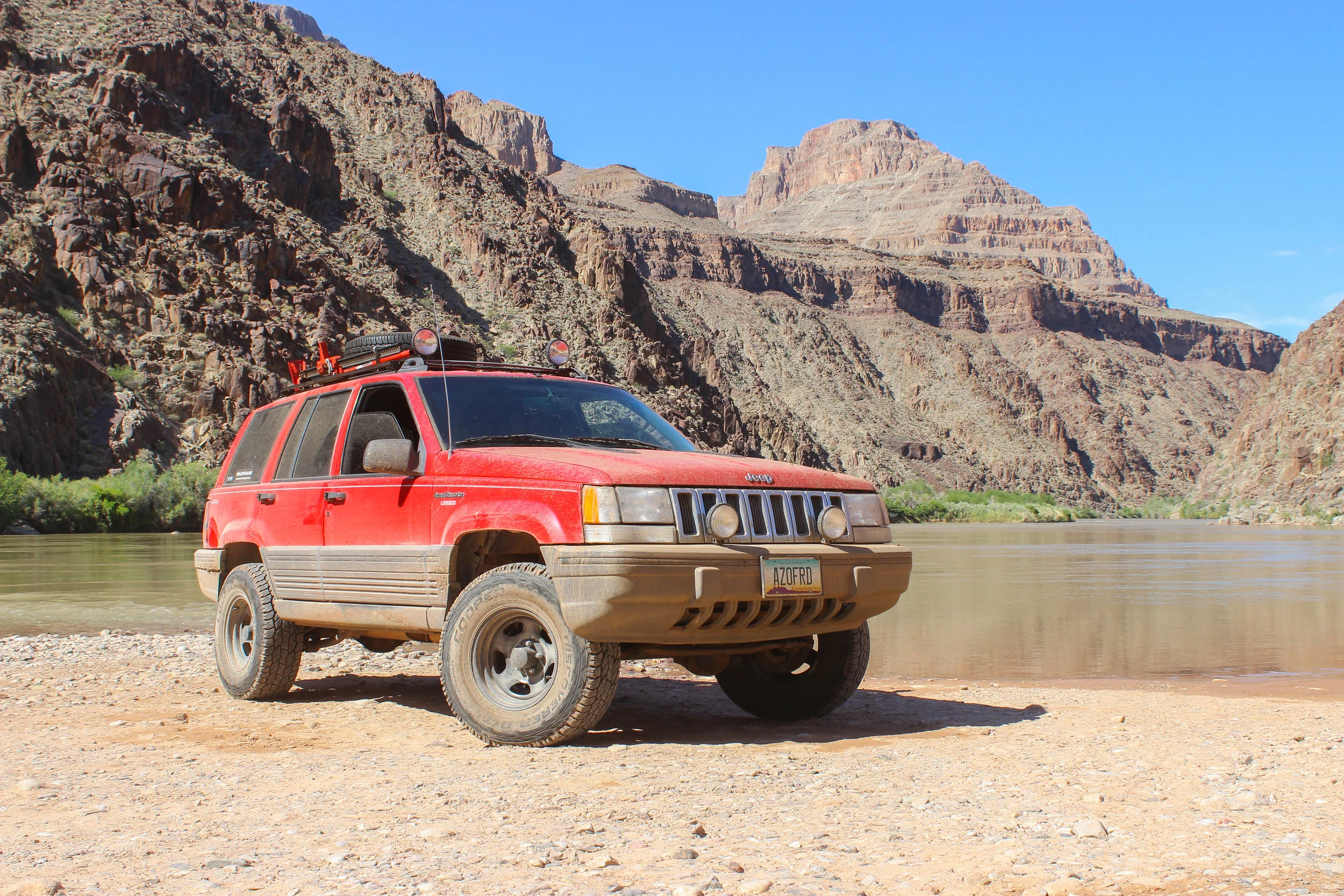
The trip down the mountain was quick. The trail was wide and decently maintained. Certainly much better than what we experienced last night. Within half an hour, we were back on level ground with Mesquite, Nevada out our windshield. We crossed the state line at around 11:00 A.M., leaving behind Arizona and the stunning Arizona Strip we had experienced over the past 5 days
Within a few minutes the paved road was in sight. We aired up as we prepared for highway cruising the rest of the way home. We topped off the tank one last time and hit Interstate 15 southbound. It was only an hour to Vegas and the time passed quickly.
Leaving Arizona and completing our 5-day journey across the Arizona Strip.
Vegas came into view as we dropped into the sweltering valley. We cruised down the strip. The completely filthy Jeep probably didn’t belong here, but that wasn’t going to stop us. We parked the Jeep in the garage and checked into the Mirage. We flipped a coin for the shower and scrubbed off about 3 ½ pounds of dirt each. It was so nice to have A/C, a flush toilet, and most importantly, a shower and comfy bed. As night descended, we headed out to engage in the debauchery that is Las Vegas.
Utterly exhausted from the culmination of the last 5 days, we crashed “early” at around 2:00 A.M. We awoke the next morning and set out for the long drive home. The Jeep fired right up and we hit lunch at the Pit Stop in Boulder City before the long 4 ½ hour drive home.
The 5 days and roughly 750 miles we covered in the Arizona Strip Trip was our longest and arguably most rewarding trip to date. With lack of any easy access, you truly have to want to explore this remote and scenic region. Be sure to check out our trip summary and individual trail and historic site pages on our website if you’re planning a trip to this area. It is absolutely worth it.
We win the award for dirtiest vehicle in the Mirage garage.
Special Thanks to:
Bureau of Land Management: Arizona Strip Field Office
Kaibab National Forest: North Kaibab District
All our family and friends for the continued support.